Sunday, 02 – 04 – 2006.
It is five to 3 p.m. It is a marvelous day with very few clouds in the sky, weak wind and the temperature in the shade is good. This week, Abrolhos was on the route of a strong cold front which had passed alarmingly by São Paulo just a couple of days before. I hardly slept on that Tuesday night, on March 29, due to the noisy thunders. On Wednesday, the following day, when we took the plane to Porto Seguro, I could see that the cold front had already passed by Rio de Janeiro and was going to Vitoria. Weak but active, it would reach the south of Bahia on Thursday, the second day of this trip.
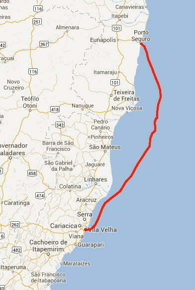
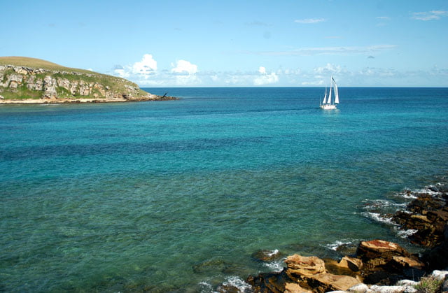
We have been to Abrolhos since Saturday morning, on the way we could feel the effects of the climate change. The wind that traditionally blows during this period of the year, the Northeast wind, was blowing from the Southeast. The waves and the currents, which normally are favorable, were against us. This is the reason why it took us 15 hours and a half, pushed by the motor not by the sails, to cover 92 miles from Porto Seguro to where we are. This is the first available time I’ve got, after five days, to summarize what we have found out during this stage of the trip.
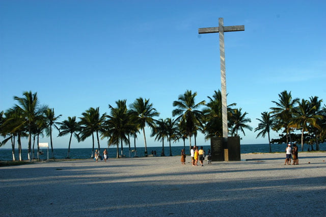
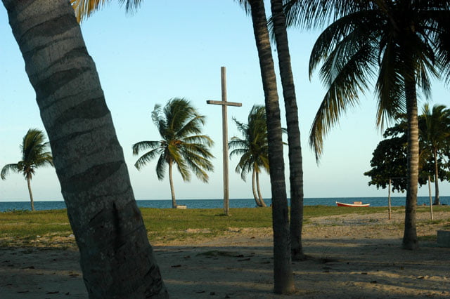
On Wednesday, the day we arrived, we rented a car to shoot in Coroa Vermelha and Santa Cruz de Cabralia, which are approximately 20 kilometers north of Porto Seguro. We had to shoot the place where the first Mass was celebrated as well as the bay beside it; which Cabral called “Porto Seguro” (Safe Port), but today it is called Cabralia, in his homage (in 1817 the bay baptized by Cabral as a safe shelter was called Cabralia, and Porto Seguro is just the name of the city on the Buranhem River’s bank.) We arrived late in Coroa Vermelha; we couldn’t shoot a lot. We returned the following day to shoot more parts I wanted to show. It is a very beautiful place; a huge and calm bay with a quite narrow entrance due to a sandstone reef, as if there was a door, and inside there is “room for over 200 ships”, as wrote Pero Vaz de Caminha. I wanted to call your attention to master João Faras, a royal doctor and astronomer, someone from Cabral’s fleet whose mission was to find and describe a star or a group of them which could help the sailors to know the latitude and the estimate position; having the same function and importance the Polar Star had on the northern hemisphere. Master João went beyond that. He got off with his astrolabe in the middle of the tumult due to the unprecedented meeting between the natives and the Europeans; he not only described it but also baptized the most remarkable and beautiful group of stars in that part of the sky: the Southern Cross. All the sailors after him used this constellation and its marks to situate themselves. It is still used as a guide and a sort of celestial arrow ready to show the direction to those who are lost. Part of our shootings was devoted to this discovery; we shot a couple of other scenes to show more evidently Pedro Alvares Cabral’s good taste. The bay called after him is probably one of the most charming creeks in the south of Bahia. Fortunately, it is very little occupied. I haven’t seen tourists’ houses, only Pataxo Indians’ stands where handicrafts are sold; there are also a few “bar and restaurant” stalls. It is amazing. It is less than 15 kilometers south of Porto Seguro where there are crowds and a McDonald’s. It is Bahia’s most popular place. There are visitors from all types of social classes, from the wealthiest to mass tourism.
In the south of the Buranhem River there are two of its districts, Arraial D’Ajuda and a little bit further Trancoso; both are superlative in terms of mass tourism. In that area there are over seven thousand beds spread in 120 hotels and pousadas. The notorious resorts have come more recently.
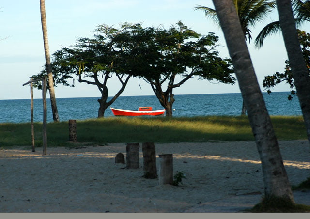
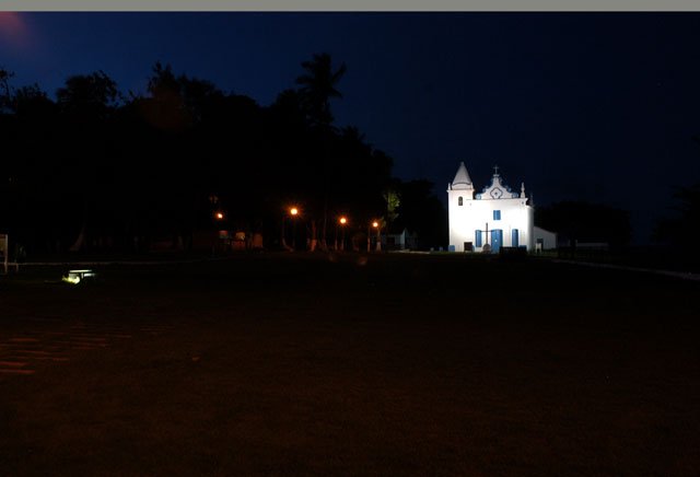
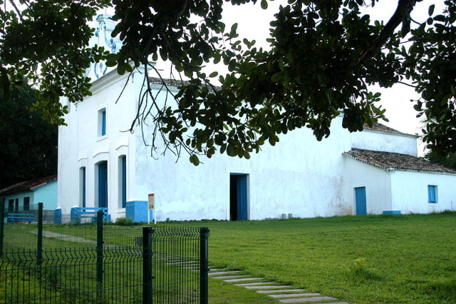
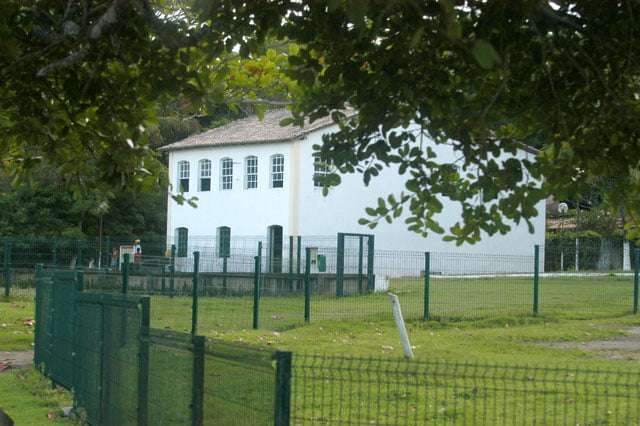
After Coroa Vermelha, we shot Santa Cruz de Cabralia’s old center which is another settlement on the banks of the João de Tiba River. Like Porto Seguro it was founded by the first colonizer, province head Pero de Campo Tourinho, during the first half of the 16th century. It is a beautiful place like the neighboring villages. As usual, it was built at the top, preferably at the top of a plateau with a wide view of the sea. A church was built at the end of a plain rectangular square. At the other end, there is a prison. Between both there is a wide green carpet; the inhabitants’ houses are at the edge. Thus, in a circle, one next to the other, colonizers felt safer to face the natives’ attacks. It was so because all these settlements in the south of Bahia, the “Discovery Coast” (part of Bahia’s coast starting in Belmonte, 73 kilometers towards the north of Porto Seguro and going to Caraivas, 46 kilometers towards the south of Trancoso) kept all these sites relatively preserved. The cities grew downwards and laterally. It is precisely in Trancoso’s historical center, the famous Quadrado, where the peaks of real estate speculation can be found with the most expensive square meter of the south of Bahia. A small hut in bad shape which is 10 meters long costs 300 thousand reais. On the shoals, in the lower part where building is forbidden; there are mansions which are worth millions of dollars. But this is not all. During the high season, this place is invaded especially by people from São Paulo, sometimes there are more than 15 thousand. There might be a total of 20 thousand tourists during the high season spread in the 39 pousadas and the only resort of the area. Just for comparison purposes, in Trancoso there are 15 thousand inhabitants. Whereas, its almost twin brother, Quadrado de Cabralia, is very cool, with only three or four foreigners’ houses, especially from Italians and some other houses belong to the natives. In addition to the level of occupation, the biggest difference is the conic Cabralia church, which is rarely seen, only in Pernambuco in a chapel near the lighthouse of Santo Agostinho Cape. The tower has this shape to guide boats which are near the coast.
I was shocked by the difference between the villages. The same style and the same beauty, but just one of them is full of tourists, rich and famous people. The other seems to preserve even the rhythm of the first colonizers’ times. It is better like this.
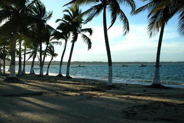
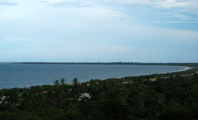
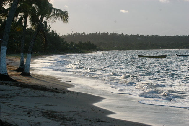
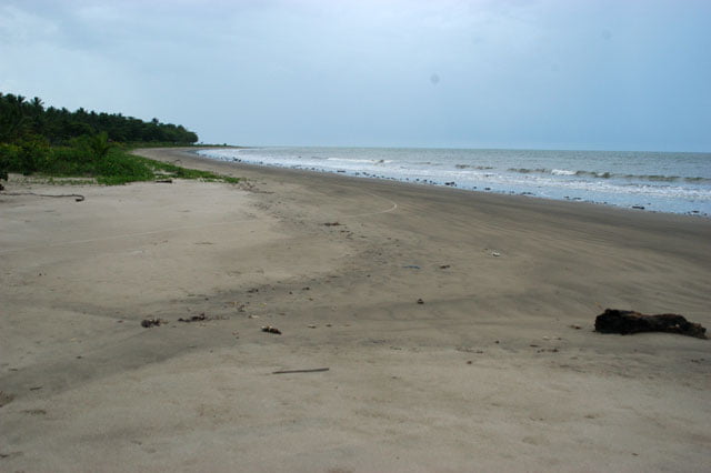
Usually, the sand strips of the beaches in this part of Bahia are long and narrow. Many have reefs and corals and just a few have sandstone reefs; the old coastal line that was exposed to the regression movement of the oceans in past eras.
The road which connects these coastal cities, BA 001, is quite near the beaches, about 200 meters away, maybe a little bit more. There is an empty strip of land between the sand and the paved road which is often formed by vegetation. This made summer visitors build their houses on the other side of the road without damaging the natural beauty of the shore which is almost the same as that of old times. Unfortunately, resorts are coming here as well. When they are built there is often devastation. On our last trip, we visited two which were being built near Belmonte and here downwards, in Trancoso, two of them will be inaugurated soon: Terravista Golf Hotel & Spa, and Leopoldo Beach Terravista; both from the Terravista complex which already has Trancoso’s Club Med, with a golf course with 18 holes and a private landing camp. That’s the reason why when you look from the sea, the area from Porto Seguro to Trancoso already shows evident signs of erosion, and the top of the crags are densely and irregularly occupied. These “anthropic” changes are seen as irreversible and start to distort the beauty of the landscape and that of the maritime biodiversity. The district of Porto Seguro has sub-districts with very little infrastructure. Only 23.8% of the 23,900 houses have waste treatment systems. Whereas 79.7% have garbage collection regularly (IBGE 2000).
Attracting tourism to make economy grow, generate jobs and increase the revenue of the local community is a great and possible solution for the coast. However, to bring it to distort the local exuberant scenery, a national patrimony, is unacceptable. It also contributes very little to the local economy, by aggravating the pollution and the social tensions; to me all this is an inconsequent waste which we will regret.
Here is the explanation: resorts are successful here due especially to an aggressive policy of Bahia’s government. This occurs at different levels of intensity in almost all the states of the Northeast. The honorable exception is Paraiba, whose Constitution was already mentioned and praised in these logbooks, which prohibits building on the coast. Through Prodetur-BA (Bahia’s Tourism Development Program), founded in 1991, policies were adopted to improve the infrastructure of the state of Bahia. There were among other things the expansion of Salvador and Porto Seguro’s airports and the construction of the roads leading to the beaches. Many of them were built: Ilhéus- Itacaré, Porto Seguro-Trancoso, and the Green Line connecting Salvador to Sergipe. The latter is the hotels’ communication means on the Coqueiros’ Coast (in the north of Salvador), among which there are Sauipe’s monumental complex and that of Forte’s Beach “Ecoresort” (which has nothing to do with “eco” since it doesn’t preserve the environment at all) as well as other giants which are being built, the Pharaohnic Iberostar in the middle of the beach in neoclassic style.
Bahiatursa’s president, Claudio Taboada, says that from 1991 to 2006 the state government invested almost two billion dollars on tourism improvements. 1.4 billion dollars have been spent so far (interview given to the newspaper “O Estado de São Paulo on July 26, 2005).
Now the results start to be visible. And I don’t like what I see. Our governors are not statesmen. They are unable to have a long term perspective; they haven’t any historical sense either. Not stealing is already a lot; most of them have a high level of myopia in addition to short horizons, politically speaking. They want immediate results. Regardless of the fact of affecting future generations and their own families. This is what they have been doing in the Northeast, either by encouraging tourism frenetically and without any protection rules, or by importing from East Asia and Central America the predatory activity of intensive crustacean culture as well as by stimulating it with public funds through financing programs and other practices. Obviously, those who benefit from it are always the elected governors’ opportunist fellows, their Congress peers, or allies and businessmen who very often support their campaigns. Unfortunately, I jump to this sad conclusion now that we are about to leave this part of the country and after all I have seen.
The damage is visible when travelers enter in the Northeastern waters of the Parnaiba Delta, on Piaui’s short coast. There in the continent, you can see the damage caused by the deforestation of mangroves which were turned into pastures, salt mines or shrimp farms which also pollute estuaries. Meanwhile, the maritime space is divided into lots by fishing companies which despoil our last storage of lobsters, by hunting crustaceans with trawl-net which revolve the bottom of the sea and cause serious damage. Many boats still use rudimentary equipment of compressed air which kills, mutilates and cripples countless fishermen. When Ibama comes for surprise inspections, the date and time are previously announced in local newspapers, consequently, the whole fleet hides before they arrive. This is denounced in Piaui’s logbook.
Officially, the Northeast starts in Maranhão which is more northwards than Piaui. This state, one of the poorest in Brazil, according to IDH data, has no coastal infrastructure. There are neither roads, electricity, nor airports nearby. However, in the north of the capital, São Luis, a big area was declared as tourism priority. Then, the real estate speculation started to be practiced by smart politicians. According to what was said in the corresponding logbook, in the area called “Guaras’ Forest”, some mayors such as Carurupu’s, arrived before the traditional speculators and started to say that they were the owners of islands which in fact belong to the Union. Now they are sitting in their “properties” waiting for more valuable prices and a further profitable sale.
After Piaui, we entered in Ceara. We arrived in Jericoacoara which is a few kilometers from the border, a natural paradise devastated and turned into slums; all this is supported by the mayor. He is Spanish and doesn’t live in the village; a former van driver who made speculation a way of becoming rich. All the northwestern coast of Ceara is divided into lots, separated in provinces belonging to the king’s friends, politicians, notable businessmen, dynasties’ members whose patriarchs were old political chiefs, a few foreign investors as well as important national and international hotel chains, having beaches and dunes with fences all around waiting for the infrastructure which will add extra value to their properties and make them richer. In some of them such as Baleia Nova and Baleia Velha, maybe the most beautiful ones formed basically by dunes (Permanent Preservation Area), there are over five kilometers of posts surrounding the public area on behalf of the tourist chain, which already has about 28 projects of resorts approved just waiting for the last red tape procedures and state investments (Camocim’s airport) to start to build. Ceara’s southeastern coast is all gone a long time ago due to speculation, condominiums of all types, “theme hotels”, resorts, occupied crags, reinforced concrete in almost all the beaches, fences on the beach, and things like that.
Rio Grande do Norte is not an exception to the rule, it is quickly becoming something similar to Ceara, and it will even surpass it. Then comes a heroic pause, Paraiba with its strict Constitution which moves speculation away; however it is threatened every time there are elections (see Paraiba’s logbook).
After Paraiba, in the North-South direction, comes Pernambuco and Alagoas. The first one opened the door for predatory tourism a long time ago whereas the latter is a land without laws. Alagoa’s chaotic environmental legislation and the occupation of the coast were mentioned in several pages of the corresponding logbooks.
Then comes Sergipe’s coast which is influenced by the São Francisco River. Its coastal waters are turbid due to the sediments of the river, fortunately. Thus it doesn’t attract mass tourism. Afterwards, we arrived in Bahia, the worst situation we have seen so far. There are 28 resorts just in this state and many others are being built. All Bahia’s coast was turned into APAs (Environmental Preservation Areas) by CRA, a state agency in charge of the environment, but it is ineffective. It doesn’t work. There is no management plan; councils never meet, contrary to what was said by secretary Sara Alves. In regard to the weird concentration in two or three resorts, one next to the other, with more than three thousand beds; the director of Vila Gale’s Portuguese group, Jose Wahnon, who is building now one more resort on Coqueiros’ Coast, on Guarajuba beach, in Camaçari, which is 12 kilometers away from Forte’s Beach, said that “the great concentration of resorts was attractive for hotel chains.” He concludes saying: “Competition is healthy in this case. Nobody offers a charter flight just to meet the needs of one single hotel”, (O Estado de São Paulo’s interview on July 26, 2005).
This is another damage caused by this type of hotel. Most of them are huge for the fragile area where they were built. Additionally, the success of this undertaking depends on high concentration. A monster like this doesn’t make money by receiving thousands of tourists at a time; three or four resorts are necessary. Since tourists don’t leave the ramparts, they are not aware of what happens around, they don’t warm up local economy. Most of them stay within the hotel limits, with the same labels, restaurants, cafes, people and amenities they have in their own cities. Others, just a few, influenced by subtle advertisements, mistakenly believe they are having sustainable tourism. They prefer to appreciate carps put in internal tanks to knowing the local fauna and flora, the natural scenery or the natives’ customs. Their arrival and departure occur through airports which are only an hour away. Thus the guy barely puts his feet on the unknown land. He just leaves the seat of a charter plane to take another seat in a van with air-conditioning. From there he goes to the hall of a hotel which might have chosen a group of semi-naked mulatto women to welcome him as if they were “real” Baianas. Then he goes to a room where the fluffy carpet probably rubs his chin; it is exactly the same as in his house. He leaves the hotel to do the same he does in the city where he lives. At the end of the season, he repeats the same operation and in a few hours he gets back home, in another country, with plenty of pictures of parrots, cockatoos and carps to show to his friends.
Well, I recalled a lot of what we have done. It still remains the sailing up to this point. But I will leave it for tomorrow. The silence which reigns in the boat is broken by Cardozo’s thunderous snore. That’s why he sleeps on the cockpit. It is 11:30 p.m. I am asleep too.
Monday, 03 – 04 – 2006.
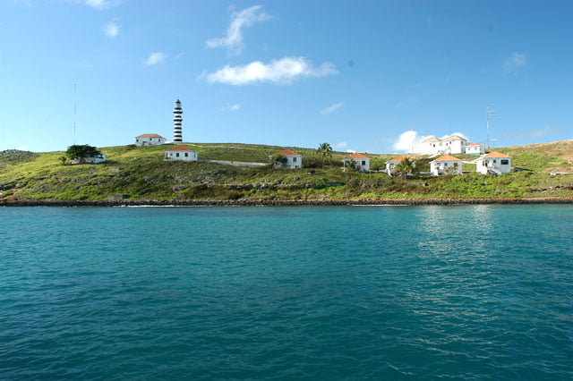
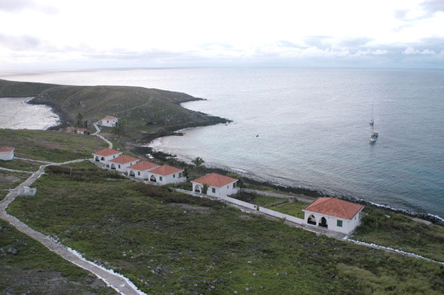
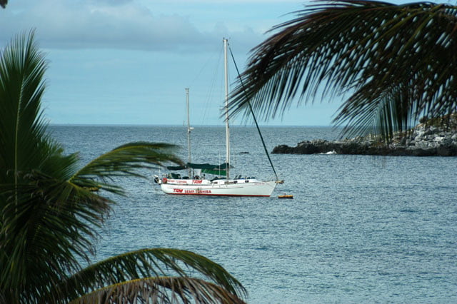
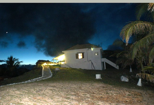
The Endless Sea is anchored on the north side of Santa Barbara Island, Abrollhos’ biggest archipelago, on the same side where the houses of the Navy of Brazil’s garrison are. Five families live here for two years, then they are replaced. We are waiting for the submarine film maker whose nickname is Perereca and who is coming from Caravelas to meet us. Meanwhile, I write my logbook.
On Thursday, March 30, after we left Santa Cruz de Cabralia, we went northwards to Santo Andre, then to Santo Antonio, two other villages towards Belmonte. I wanted to see the occupation on the coast. It is amazingly free, just with a couple of houses. On the way, the landscape remains unchanged. Long, narrow beaches, some of them with corals. The other side is covered by sand banks until they reach the Atlantic Forest inwards.
At the end of the afternoon we returned to Porto Seguro’s frenzy. We had lunch and went to the supermarket. We got back to the sailboat in the evening and prepared ourselves to leave the next day.
We left on Saturday, at three p.m. It was a cloudy day, the result of the rest of the cold front. There was a weak southeast wind. I checked a meteorology site and saw that it was the rest of the front. We left right after.
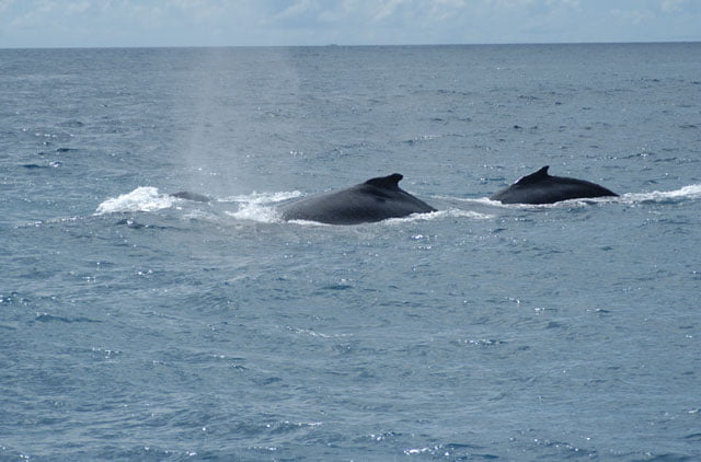
Out of the break-water in the sea, the strength of the wind went to 15 knots. There were some waves coming on the opposite side which made our boat pitch and toss. It was not unpleasant, but it rained a little. Alonso was at the rudder most of the time just checking the horizon since the automatic pilot was on; this marvelous board fellow. Sometimes we had to avoid a few fishing boats. There are too many in Abrolhos. But this can be easily explained since it is one of the richest parts of the poor Brazilian coast in terms of fishing biomass.
Usually, our continental platform is narrow. It ranges from 20 to 50 kilometers at most, then it drops to abyssal depths, more than four thousand meters deep. One of the exceptions is the south of Bahia (the other is the mouth of the Amazon River), were the platform covers approximately 200 kilometers; it is exactly where Abrolhos’ coral banks are.
We have already said that the richness of this ecosystem rivals the tropical forests. An uncountable number of species live in this environment. Fishes, algae, mollusks, crustaceans, micro-algae which give them color, polyps, thousands of micro-organisms, etc. This is the reason why this area attracts fishing fleets. During the night, we zigzagged to avoid the other boats. I replaced Alonso at three a.m. and it wasn’t different during my shift. An eye on the prow and another on the radar screen, all the time.
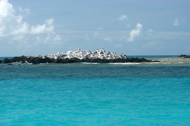
In 1983, Abrolhos became a Maritime National Park, one of the few protected areas of Brazil’s seas. I’d like to call your attention to this: about 23% of Brazil’s land territory is protected in the form of parks and things of the sort, and less than 1% of our seas is treated like that (less than 0.5% of the world’s seas are protected)! The disregard for the maritime space costs a lot, and from now on it will only increase. It is like Brazil’s interest rate. One step forward, two backwards. The total area of the Park is 913 square kilometers, 110 kilometers in Recife de Timbebas. However, like most of the national parks there is almost no infrastructure. To start with, the park keeper, who is in Santa Barbara, has only one rubber boat with a small stern motor which doesn’t enable him to go too far to inspect fishing within the limits of the park. This makes boats daring in regard to legal rules by throwing baits, harpoons and traps in forbidden areas, thus decimating the fauna to such an extent that you rarely see a parrot fish (an ordinary fish in reefs) out of the perimeter of the five islands that form the archipelago. When you dive in Parcel das Paredes, which is between Caravelas and Abrolhos, in addition to the fact that it takes hours to see a fish, it is almost impossible not to find damaged coral or even destroyed by the anchors of these boats. It is such a daring attitude that the present park keeper, Mauricio de Oliveira, from Santos, told us that one of these nights, when he was walking along the west end of Santa Barbara, he noticed there was light behind the hill of Ilha Redonda just in front. He took his boat immediately and went there to check what it was. It was a boat of professional divers who with their harpoons devastate the fauna of the bottom of the seas by choosing the greatest and best fishes just under the nose of the pompous Maritime National Park. Mauricio has not the power the police have; he just gives lectures on environmental education. However, when he surprised the intruder, he asked him to follow him to the Navy’s float which is in front of Santa Barbara Island. At first the motor boat obeyed. But on the way he tried to follow him and noticed he couldn’t go as fast as him. Then, he simply turned 180 degrees, sped up, and escaped easily, ignoring Mauricio. Just like that. Of course, guess how the daring bandits would react if the Brazilian police were unarmed. Well, this is what happens here. On the islands and on the Brazilian coast in general, the law of the strongest reigns due to the criminal omission of the State.
But this is not the only threat to Abrolhos’ corals. We talked to an important expert from Bahia’s Federal University, professor Zelinda Leal, and she told us many things. To start with the fact that Bahia’s coast is divided into lots for oil extraction, in auctions organized by ANP (National Oil Agency). This area was recently protected from auction at the last minute due to the reaction of environmentalists, teachers (among them Zelinda), NGOs and researchers who got a temporary restraining order. They asked the government to have more time to examine the area thus minimize the risk; and if they succeed, it will be forbidden to prospect in the area.
However, there are other threats, as serious as this one or more. One is global warming and the other is the occupation on the coast, especially due to deforestation. Do you want more? Tourism, overfishing, industrial pollution, oil leakage, just to mention the most important ones.
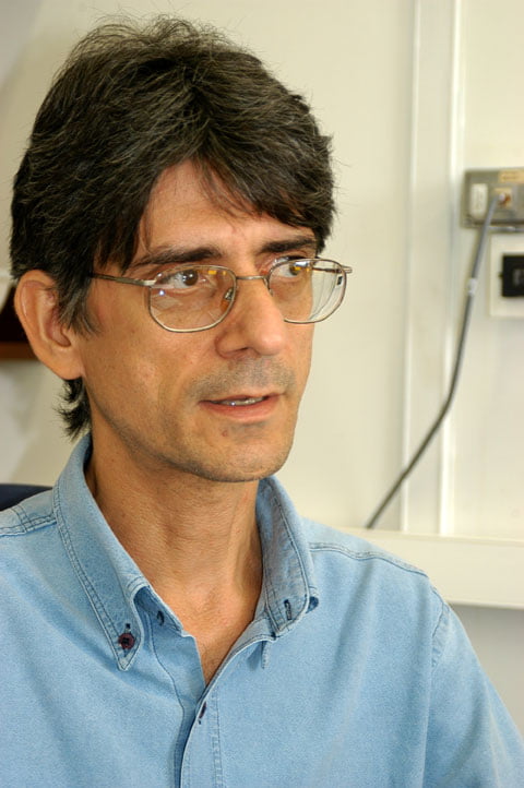
Do you still think this is all? Well, this paradise has a dark future. Maritime research is barely made in Brazil, and according to professor Rubens Lopes, from USP’s Oceanographic Institute, “management is possible when you know the field, if you don’t know, nothing can be done.”
When we spoke to Rubens, we talked a lot about the issue of scientific knowledge; different aspects. Examining the fact that 70% of the world’s population lives from 50 to 100 kilometers away from the coast, as well as FAO’s data showing that in 2010 we will be 7 billion inhabitants; he says that “the real importance of the maritime environment for Humanity is neglected.”
He explained to us that the coastal environment is the area where the greatest human occupation is found. In Brazil too. Here the average density on the coast is 87 inhabitants per square kilometer, five times bigger than the national average which is 17 inhabitants per square kilometer. These are IBGE’s data.
To make things worse, research funds in all the fields are evidently limited. The participation of the private sector to foster research is very fragile, it is still very little. According to Rubens, “this happens because the interest of the private sector remains in the result the research will bring for his own activity. The low biological production of Brazil’s sea results in very weak production; consequently scientific research has little reverberation since the population makes little use of the maritime ecosystem.” He adds: “Besides being most directly used by the population as leisure; this issue tends to change because of the gas and oil sector which has increased a lot in Brazil these two last decades. This is an interesting example of how this economical impact can be translated into a greater interest in the private sector.”
Nevertheless, we have good news. At the end of last year, a research on Abrolhos was approved by CNPq, “Productivity, Sustainability and Utilization of the Ecosystem of Abrolhos’ Bank”, the Pro-Abrolhos. IOUSP is at the head of this research which will be carried out by ten research institutions plus a NGO gathering 50 scientists from the whole country. This group will present in 2008 a “detailed investigation on how Abrolhos’ maritime ecosystem works in order to preserve it.” According to Professor Dr. Belmiro Mendes de Castro Filho, vice-coordinator of the project, the idea is supported by the following data: “the rational management of its limited biological resources.” I hope they will be successful!
Well, it is not easy. Don’t think it is any different in other parts of the world, either in regard to the pollution of the oceans, or in the scientific field. Just for the record: according to some experts there might be 30 million of animal species in the sea. Most of them haven’t been discovered and many will disappear before they are discovered.
In 1995, an estimate by American agencies figured out the world’s fishing fleet in 37 thousand big industrial boats and over a million of smaller fishing boats. They have been removing from the sea twice as much the amount of fishes fished in the last 25 years. Some companies use airplanes to know where shoals are and their nets are as big as six jumbo planes! Every year, twenty two thousand tons of fishes are thrown back dead into the sea, after they are fished in trawl-nets. According to the Economist, “we are still living in the Stone Age. We simply throw the net into the sea to see what it brings back.”
FAO’s Fishing Committee estimates that “75% of the world’s fishing is overexploited; it is a situation that may lead to the collapse of this activity in a global level.”
Nevertheless, present data show that with the collapse of the traditional fishing in the north hemisphere, the efforts of the industrial fleets are now oriented to the African coast and the Pacific. According to Dr. Daniel Pauly, a Canadian expert “if this continues at this rhythm our children will eat jellyfishes.”
Here is another thing that will make you sleep well. This information is about the world’s lack of information on the sea. In 1957/58 the world’s scientific community decided that that year would be Geophysics International Year. In world congresses, oceanographers studied the bottom of the seas for radioactive residue’s storage purposes. This was debated publicly. In 1964, believe it or not, the United States started to throw into the sea radioactive residues put in barrels of 208 liters, more specifically in the Farallon islands, 50 kilometers away from California.
This was only stopped in the 90s. More than 50 thousand barrels were thrown in the depths of Farallon. Besides the United States, Russia, China, Japan and other European countries did the same in several areas of the oceans. We have made some progress at least in this area. Today, ships which cross the oceans with radioactive garbage are monitored by NGOs and are treated like floating pariahs; just a few ports receive them due to the international pressure.
But the thing is worse. I will talk about this later on as well as about the pollution in other seas which is as serious as ours, sometimes worse. Now, I have to return to the trip to Abrolhos. Let’s talk about it.
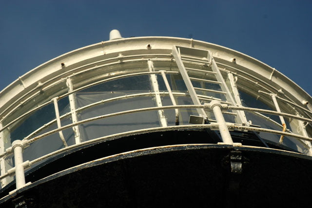
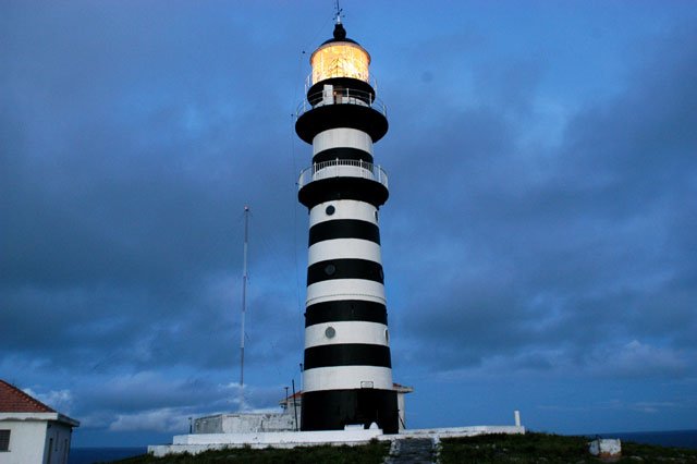
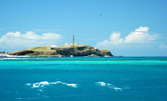
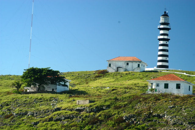
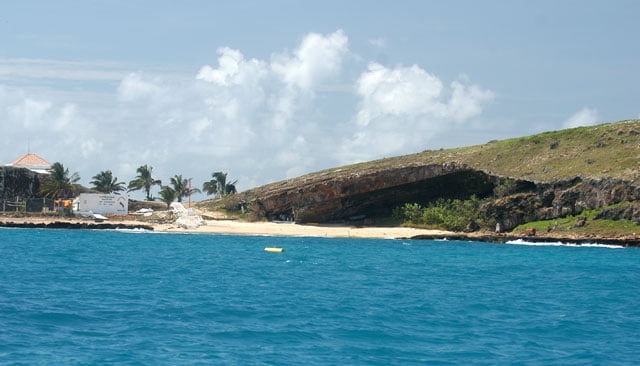
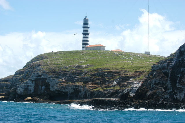
Alonso replaced me at 6 a.m. The light of Abrolhos’ lighthouse had been guiding us for a long period of time. I went to bed. I woke up again much later when the sailboat had already been tied to one of the weights which had been put to avoid continuously damaging the corals.
We didn’t do much. We dove a little bit beside the boat to enjoy the bottom of the sea since there is very low depth and the water is crystalline. It is a privilege to dive in Abrolhos, even with a cold front which revolved the waters moving sediments that are now in suspension causing some turbidity. In spite of that, visibility is fantastic as the treated water of a swimming pool.
At midday, for breakfast we roasted pork chops in the oven. Delicious. Then each member of the crew got back to his place. At the end of the afternoon we had lunch and then went to bed.
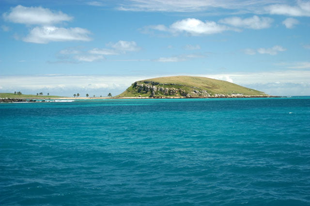
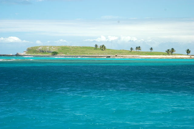
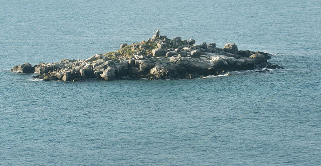
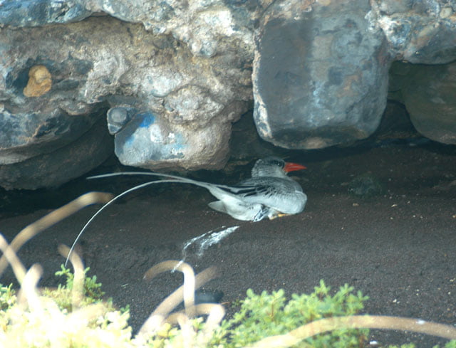
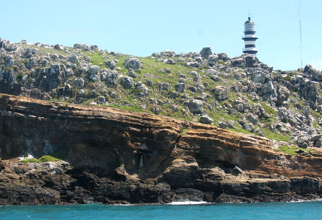
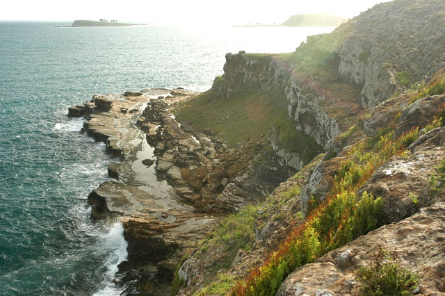
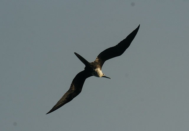
Sunday was devoted to more diving. Groupers, serranoid fishes, barracudas, turtles and other species accompanied us almost all day long. In the morning, we visited Siriba Island, the only one where tourists are allowed. Don’t think they exaggerate. There is scarcely vegetation on the islands; normally it is extremely dry since it rarely rains. The land layer is very thin; it is not very deep since these are volcanic islands, formed between 40 and 50 million years ago by submarine eruptions which deposited lava at the bottom of the sea. Little by little calcareous algae, corals and other organisms were fixated on it until the archipelago we are visiting now was formed. Life in the water is extremely rich and complex, on the island it is arid and the vegetation is poor. It attracts just a few types of birds: frigates, white atobas, puffins and a few others. Apart from them, just a few reptiles adapted themselves to the climate. The ecosystems are very fragile in the water as well as out of it. If tourists were allowed on other islands, if the tracks were not previously delimited, avoiding whenever it is possible stepping on the vegetation, I don’t know what would remain from the archipelago.
Mauricio took us for a short walk. On the way I noticed that there were a few she-goats left in Santa Barbara. I’ve already told you that Portuguese sailors used to leave a couple of these animals on all the islands they visited; this is probably one of the few attitudes I really don’t appreciate. These miserable animals survive in any type of situation; they rarely drink water and eat whatever they see: stones, sand, garbage, gravel, grass, trees, roots, anything. They were eaten on long journeys which very often decimated a great number of sailors due to diseases such as the scurvy caused by the lack of fresh food. The animals I saw, and there are quite a lot, come from the same ruminants left by the Portuguese. I regret that Ibama doesn’t eliminate them all once and for all. They are only used to be grilled and eaten by the garrison’s sailors, all the rest devote their time to eating what is left from the poor vegetation.
I don’t know if Abrolhos with its restrict area and aridity had a very rich vegetation in the past. I don’t think so, however, I believe that there were a few bushes, small trees and probably more than ten or twelve palm trees which can be seen today. In spite of that, Ibama’s people believe that the she-goats and goats are not really harmful and allow them to graze in the poor vegetal coverage left. Poor islands…
In the 19th century, Fernando de Noronha still had vigorous forests. Charles Darwin was one of the witnesses who described it. Trindade, which is 600 miles away from the coast of Espirito Santo, had such a thick forest until 1922 that explorer Robert Scott on a trip to the South Pole allowed his crew members to get off and found it difficult to find them later. The forest was so dense that Scott had to shoot to enable his men to find their way back. In spite of that, the two islands and Abrolhos are naked today. This was not only due to the inhospitable climate. The she-goats introduced by the Portuguese played an important role. But in the 16th and 17th centuries, people didn’t use wood to cook. The steam motor came much later and the fuel used was charcoal and wood. It was like this until the combustion engine came in the 19th century. Finally came the interference of the modern man who brought pollution, tourism and other types of occupation. The straw that breaks the camel’s back. The result is clear. Very poor vegetation, except some palm trees on Redonda Island, others on Sueste and one single tree on Siriba, if I’m not wrong it is a Chapéu-de-sol (Parasol). I asked Mauricio about the she-goats, but he thinks they are “self-sustainable” and they represent “some meat”… What a pity! If it depended on me, there wouldn’t be any left.
Thus we spent one more day in Abrolhos. In the evening we enjoyed the sky full of stars, the silence and great feeling of being alone in a wonderful place at least for the time being, in a paradise in the middle of the sea.
Tuesday, 04 – 04 – 2006.
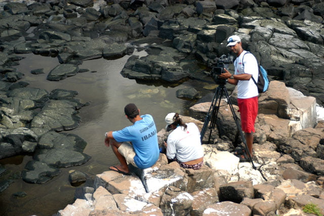
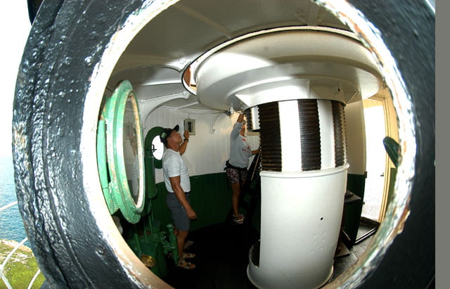
Yesterday, at the end of the afternoon, after we went downstairs from the tour of the Lighthouse inaugurated in 1861, we saw Perereca’s boat arrive. He threw a cable to the Endless Sea which was anchored on the Marine’s buoy, in order to spend the night together. Today we are going to dive. I’ll tell you about it later.
The water was not perfect. The strength of the cold front and the change of the wind direction bothered us a little bit. There was some suspension and turbidity and we had to face some current. We had to be careful all the time, to correct our body posture with our feet and hands to keep a good position for observation in the water. Despite these difficulties we were able to record in the form of film and pictures enough images for the two programs we intend to make. This is what matters. We dove in two or three different points to record the biggest possible variety of corals. Then we returned to where we were anchored at Santa Barbara Island.
Wenesday, 05 – 04 – 2006.
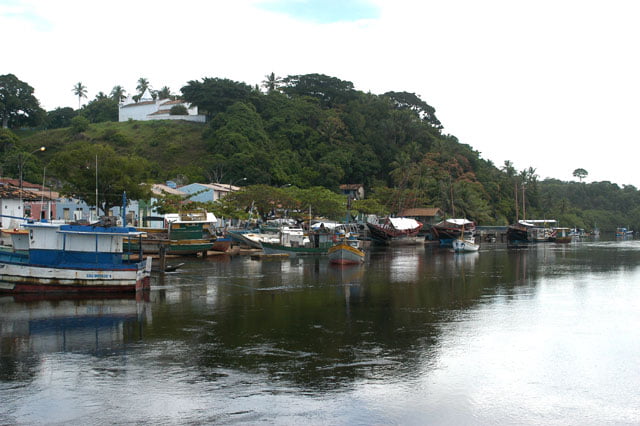
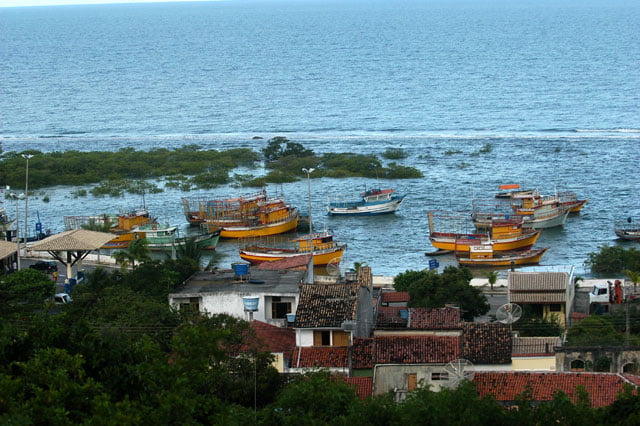
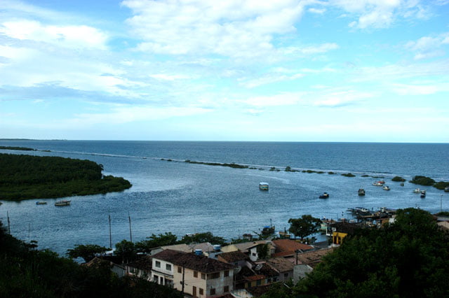
This morning the film maker’s boat left us at dawn. They returned to Caravelas, 30 miles westwards from where they had come two days ago. It is from Caravelas and Alcoçaba, another city a little bit upwards, where a big number of fishing boats leave trying to be successful at the Abrolhos’ bank. I have visited these cities recently and I was amazed at the number of boats I’ve seen. There were thousands of them. In Cabralia and Porto Seguro, from where we left, fishing lobster is the most frequent activity. We saw huge lobster fishing boats stopped in Cabralia, just waiting for the end of closed season. In Brazil, the remaining lobsters are fished from Piaui’s coast to the south of Bahia. Downwards, from Alcobaça, there are predominantly boats which use nets and fishing lines to catch shoals.
We dove again but this time in apnea. After we got tired, I sailed around the islands with the Endless Sea to be able to shoot images from all the angles of Abrolhos. Then we returned to the point we were anchored for our last night here. Tomorrow we are lifting anchor to go to Vitoria. We are definitively leaving the Northeast to enter in the Southeast.
Thursday, 06 – 04 – 2006.
Before we started our sailing, we put the sails of the Endless Sea up and passed by Santa Barbara and Redonda Islands, with a depth of approximately 4 meters, where the blue of the water is fantastic, almost transparent, ranging from the darkest blue to the emerald green. Then we put 240 degrees on the magnetic compass and almost without wind just with a weak southeast wind, we started the last part of this trip.
I’ve said before that I would talk about the pollution issue in other seas just to avoid the impression that this is the only country where this occurs. Well, I have here an article whose title is “No cure for sick seas” by journalist Diego Cevallos, and the data that he shows are terrifying. The main subject is the Caribbean Sea and among other things he says: from 80% to 90% of the waste come from the earth and reach the seas of the area without any treatment. According to Chris Corbin from PNUMA (United Nations Program for the Environment) this is a great problem. And he added: “Most governments don’t see the contamination of the seas and rivers as a priority. Many international agreements and commitments are signed, but they are just words.”
Latin America and the Caribbean have 64 thousand kilometers of coast and 16 million square kilometers of maritime territory which are daily affected by thousands of tons of waste coming from urban, industrial and agricultural zones. Seventy out of the seventy-seven biggest cities of this area are on the coast and 60% of the population lives less than a hundred kilometers away from the coast. According to the article, just 2% of the waste is treated before it reaches the rivers and seas. There are disastrous consequences. A Cepal’s study (Economical Commission for Latin America and the Caribbean) shows that some mangroves and coral reefs were damaged beyond their regenerating capacity. Additionally, in all this area there is a decreasing fishing activity. Some research carried out by PNUMA show that “the consumption of food from coastal zones and that of fresh water from contaminated areas produce approximately 2.5 million cases of hepatitis with 25 thousand recorded deaths.” Cholera, diarrhea and many other skin infections are also straightly connected with the contamination of the seas.
Felipe Vasquez, a researcher from the Institute of the Sea Sciences from Mexico’s Autonomous University (UNAM) states that “the governments are paralyzed” in regard to the progress of the maritime contamination and the measures taken are very few and dispersed.” He concludes: “This is the present situation in mangrove areas, a decaying ecosystem whose world’s surface has decreased by 35% in the last decades, approximately 17 million hectares.” According to Greenpeace, the devastation results from contamination, urban and industrial progress as well as from agribusiness and it continues at a rhythm of 2.1% per year, whereas the tropical forests decreased by 0.8% during the same period.
Here are some data on the Caribbean, theoretically richer than us. Nevertheless, the result is mediocre. What can be expected from the African coast, either from the Atlantic side or the Indian? What about the miserable southeast of Asia? As you can see, there is nothing to be celebrated, on the contrary. Brazil is not the only country where the seas don’t attract the public opinion. Unfortunately, this is a world-wide disregard.
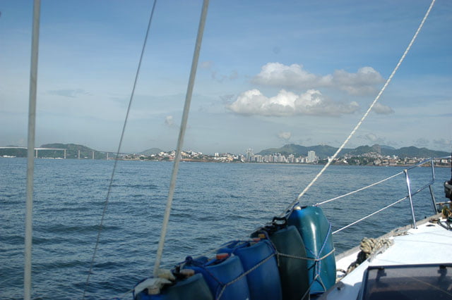
We are returning now to our trip. We sailed 190 miles from Abrolhos to Vitória for many hours and had no problems helped by the motor and the main sail. We anchored at Vitoria Yacht Club at 8 a.m.
We are going back to São Paulo now. We are going to edit the material and will be back soon to know the coast of Espirito Santo. I will be waiting for you.