Thursday, 3 – 11 – 2005.
The wind changed! The troublesome and powerful south-east wind is not following us any more. The winds come now from the east quadrant. How nice, it was about time.
This is the first thing I noticed after we landed yesterday afternoon at Recife’s airport. I was looking forward to this change seeing that we had been suffering with the south-east wind contrary to our destination.
I intended to start this series in January, but due to TV Cultura’s red tape, our first program was shown only in April. If my demand had been satisfied, we wouldn’t have gone through so many troubles, we wouldn’t have lost so many sails. Our sailing would have been less uncomfortable. My goal was to reach Ceara’s coast in July in order to cross the Northeast without the south-east wind, which as I said blows in the opposite direction making us face waves between 5 and 6 meters. But things never are exactly the way we want them to be; consequently I arrived here with the wind which made our journey from Piaui to Pernambuco unpleasant and stressful for the crew and the boat. This is the reason why I was looking forward to this change which normally occurs during this time of the year.
When I arrived in Recife from Paraiba, the south-east wind was at the top of its strength, but it is over now. The wind blows from the east and this direction will turn to the Northeast which helps sailing even more for those who are going southwards.
Besides this good news, there is another one: a lot of people know the series The Endless Sea in Pernambuco. As soon as I got on a taxi, the driver looked at me and said: “I know you”. I was surprised. I’m not used to that. While I was trying to guess from where that man knew me, he looked at my t-shirt with the logo of the program on, he said with that typical delicious accent: “You’re from the Endless Sea series, aren’t you?” We were happy to know that ordinary people were watching and enjoying our TV program. In Natal, it was the same. Whenever we entered in restaurants, the waiters would come and make comments. During a couple of trips on Rio Grande do Norte’s coast, the same type of thing happened. But hearing the taxi driver speak enthusiastically about the images he had seen in our programs made us feel proud and happy. So much the better. This was the main idea: to make the greatest amount of people understand the importance of the maritime space, its fragility, the animal, vegetal and mineral treasure, to show to the Brazilians how the coast has been occupied and surprise them with the cultural goods of the rich and diverse patrimony present in the coastal cities due to their peculiar geographic situation, on the coast. I want to remind you of a study carried out in 1988 showing that Brazilians are not interested in the sea, it is the coast that calls their attention: an atmosphere connected with leisure, tourism, sports and fishing. The importance of the Atlantic Ocean as regards the economy and security is either ignored or scarcely known by the population and opinion makers. This may explain why people don’t care about the maritime space. Whereas ….% of the terrestrial area are reserves, less than 1% of the ocean are parks or something of the sort.
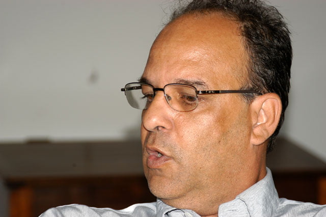
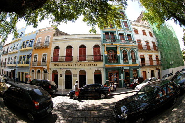
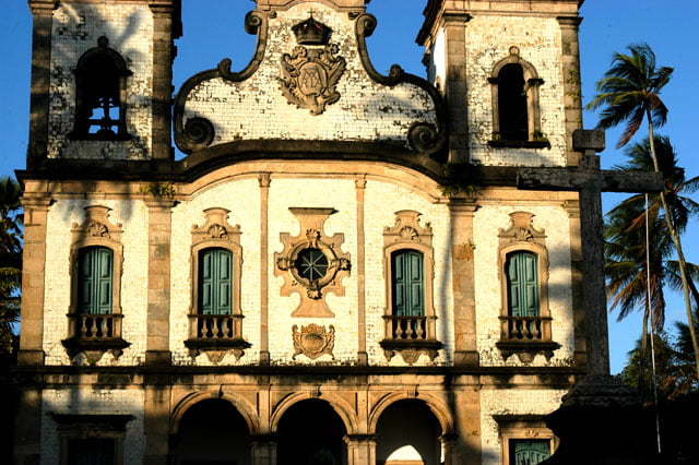
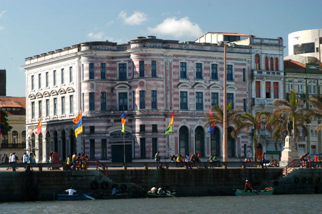
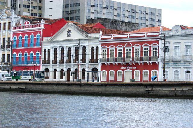
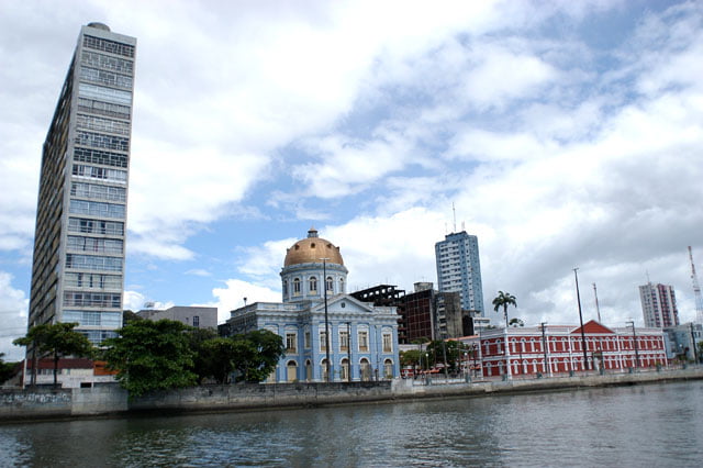
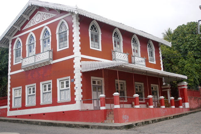
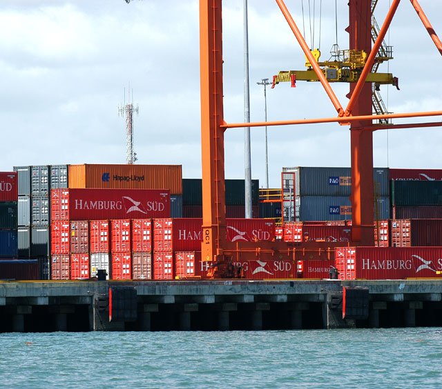
Well, on our first day we interviewed IPHAN’s Regional Superintendent, Frederico Faria Neves de Almeida, seeing that Pernambuco is one of Brazil’s richest states as regards the historical patrimony. Besides Olinda, recorded as historic site by UNESCO, there is Recife, the city itself, founded by the Dutch has plenty of wonderful historical buildings: churches, convents, forts and beautiful houses. Frederico suggested us the most important ones in Recife, Itamaraca, Igarassu and even a few sugar cane mills on the south coast which we will be visiting soon. He told us that the state with the greatest number of historic monuments is Rio de Janeiro, followed by Minas, Bahia and the fourth is Pernambuco. Just in Olinda there are three thousand historic buildings, not to mention those in the other state districts… It won’t be a piece of cake.
I asked him which was the greatest inheritance left by the Dutch, besides the historical buildings. “The design of the city with the same characteristics Amsterdam has: below the sea level, the canalization of the water system is still used today, the old fortification -nevertheless, it is an indirect influence because the Portuguese ended by building several forts to protect themselves against the Dutch threat – and eventually, Recife’s settlement and development.”
We also talked about the problems the city faces today and he expressed his opinions frankly. Frederico knows that tourism’s main attraction, which grows vertiginously like everywhere in the Northeast, are the beaches, “the historic patrimony adds value”. He is worried about the future. He said that Recife is significantly influenced by real estate speculation, due especially to the small size of the city. It is Brazil’s smallest capital in area. That’s why exacerbated verticalization makes us see ”buildings of 30 and 40 floors as an ordinary thing”.
After talking and shooting, we left in order to “cover” the interview which means to record the monuments mentioned.
We returned at the end of the day, after the sunset.
Friday, 4 – 11 – 2005.
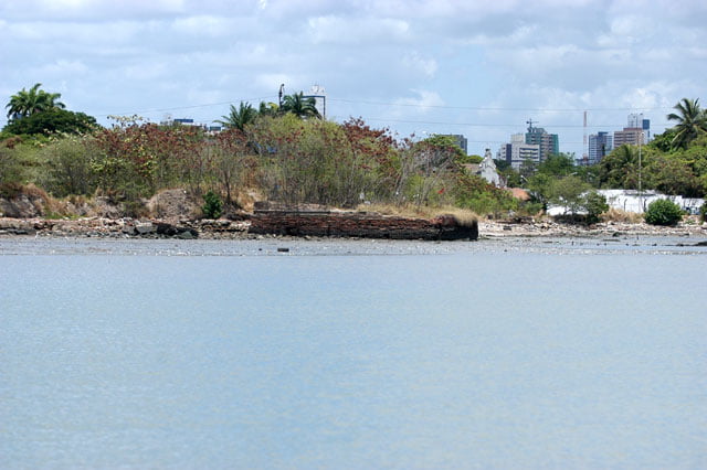
We left early for the campus of Pernambuco’s Federal Rural University. We had made appointments with several experts. The first one was with Maryse Paranaguá, an expert in mangroves, who exposed briefly the situation of Pernambuco’s coast. Between the 60’s and the 70’s, big industries were settled near the Itamaracá Island and Itapissuma, a district in the north of the island, it was the beginning of the industrial pollution. This area is the estuary of Botafogo river, known here as Santa Cruz canal, which is in the district of Itapissuma with 23 thousand inhabitants who depend exclusively on non-industrial fishing and collecting. It was SUDENE’s times, sad memory, either for dealing with public funds and benefits, or for creating development policies that were frequently wrong…. One of the consequences on the environment, in Santa Cruz Canal and other rivers of the estuary, there was the stilling of caustic soda and mercury, just to mention two of the most harmful pollutants. According to Maryse, the local community had to fight for a long time to make the companies use retention tanks.
Afterwards, came the mangroves’ deforestation, more than one third of the original amount was cut and covered to be replaced by lots, resorts, hotels and marines. I teased her asking if tourism couldn’t replace the old economic activity: fishing and shellfish. ”No, local inhabitants are necessary only for civil works. Once it is over, they are dismissed.”
After this predatory cycle, there has been more recently the crustacean culture that is sometimes devastating.
Maryse is against this activity the way it has been conducted. She told us that a significant part of the great farms belong to powerful businessmen or politicians and “both disobey laws”, they do not consider Apicum as an area contiguous to the mangroves, and part of this biome, by devastating rather than building.” Shrimp breeding should be self-sustainable, but it isn’t”. She said that in Pernambuco the crustacean culture devastates not only mangroves, but coconut trees too. “Since they remove the mangroves that protect the coast line, the tides come further and make coconut trees fall. It was like this in Itamaraca.”
Maryse also spoke about the erosion and invasion of the sea in Jangadas Bar, for the same reason: the mangroves’ devastation, but this area had already been urbanized and some buildings simply fell and others are seriously affected.”
Obviously, this caused a great loss in biodiversity in one of the richest areas of the northern coast of Pernambuco.
We will be there and see.
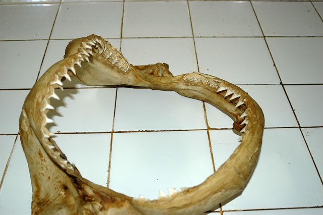
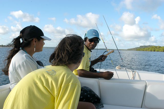
Then we had a talk with Paulo Oliveira, a teacher from Bahia, “lent for Pernambuco”, a researcher from the fishing oceanography laboratory from the Federal Rural University. He is an expert in sharks, a fish about which there is very little research, with a few species threatened with extinction in several waters of the planet, in spite of the fact of not being included by Ibama among the species threatened in this country. It is known that Pernambuco has the unfortunate record of shark accidents on the Brazilian coast. There have been 46 attacks with 18 deaths since the 90’s. That’s why our TV program had to show something on this matter and contribute to reveal the mysteries and legends involving the shark, unfairly seen as the sea villain. Additionally, this shows the origin of this ecological imbalance in the sea, again due to the wrong occupation of the coast.
Sharks started to attack in 1992 at Recife’s metropolitan beaches. Studies were carried out, multidisciplinary groups were created, the state government participated in the campaign and the results show that the presence of sharks (the tiger and flat head types – two of the most aggressive) was caused by the mangroves’ devastation. Yes. Again they were victims of a badly planned occupation. Although it is a huge work and very important for the state and district economy, by offering jobs, paying royalties for the cities that are affected, being a direct outflow of the production for consumer markets and certainly contributing with progress, I wonder if such a great environmental impact was really necessary. But what matters in fact is to know that to build the huge Suape’s port and refinery, vast mangrove areas were devastated. They were the nursery of flat head female sharks which used the estuary to give birth to the young. When the habitat is devastated, the shark looks for a substitute to continue its life cycle. Since the winds are predominantly south-east, the individuals which used to be in Suape went up the coast, pushed by the streams formed by the wind and the first one found is that of Jaboatão river, in Recife. Then a chain of factors seem to escape sneakily from a “bag of evils” and give their contribution. Two of them: Jaboatão’s slaughterhouse and the liquid waste from Muribeca’s landfill. Professor Fábio Hazin, an expert from Pernambuco’s Federal Rural University wrote the following: … it is reasonable to think that throwing blood and guts in Jaboatão river, which flows into the beach where 45 out of 46 attacks occurred, has a significant potential to attract sharks…” and a little bit further, he criticizes the authorities: “Throwing this type of waste directly into the water causes such a harmful environmental impact that a FAO’s manual states that…” then comes a series of recommendations from the UN’s agency. In this study, before talking about the impact of the slaughterhouse’s effluents and the liquid waste, professor Hazin explained to us the reason why sharks have such a good olfaction. To begin with, the shark is a predator at the top of the food chain, and “it has well developed olfactory bulbs, which give it an extremely acute and effective olfaction to find possible preys.” The study also shows that in 2000 this slaughterhouse threw its effluents without any treatment, approximately 345 cubic meters per day, “this volume is 20 times bigger than the second greatest source of pollution”. Finally, the teacher explains that “Jaboatão’s waters are spread at Recife’s most important beaches”. Maybe the pollution level is so high that they leave the estuary in search of another place nearby. They end by going to reef areas, the same that are around urban beaches. Here they find abundant food, due especially to trawl-net fishing, a hundred, a hundred and fifty meters away from the coast. As I said, for each kilo of the species fished, 80% of the fauna is caught with it and thrown back dead to the water, being the easiest lunch and diner that the tigers and flat heads have ever had. That’s why they remain in that area, even after the female gives birth to the young. Since they are at the top of the maritime food chain, they are attached to their territory, that is, they defend literally with their teeth the territory where they are and from which they intend to take their food. And sometimes they find unaware surfers who cross reef areas in search of greater waves. Then the sharks notice an indistinct shape (waters are turbulent, turbid) as big as the shark itself (tigers and flat heads are from 2 to 3 meters long), and attack it immediately, thinking it is a sea rival. And they bite. As soon as they realize it is not an animal for their diet, they let the prey, but very often it is too late. Their jaws are mortal. Powerful teeth, sometimes there are seven rows of the sharpest teeth. With a small bite they are able to cut meat and saw the thickest bone, tearing completely the bitten member. Whenever the person who was attacked in Pernambuco died, the reason was the victims’ blood loss by only one bite (released right after)…
And in spite of this warning, the pain and the deaths, in spite of all the noise made by the press, mangroves in the north-east are being devastated and given to crustacean breeders or real estate speculators, regardless of the fact of being APPs, permanent preservation areas. There are not only native examples, there are also the international ones. According to studies carried out after the devastating tsunami this year in Asia, it was proven that in the mangrove areas there was less damage since they protect the coastal line against forces that come from the sea. It is very sad to know all that while our authorities play the blind and the death! They prefer to waste 200 million reais in a demagogic referendum, with a question asked in a stupid way, in an useless effort to hide the truth and to cheat. Everybody knows, including the Brazilian people, that the result of the ballot-boxes is just more evidence that the main cause of violence is the evident omission of the State, not the fact of selling weapons. If the government deals like this with the public security, why not the environment, giving the public areas, strategic for the coastal zone defense and uteruses of maritime life, to the few and good “powerful people” so that they can earn more and more, exporting thanks to destruction, pollution and social conflicts?
Saturday, 5 – 11 – 2005.
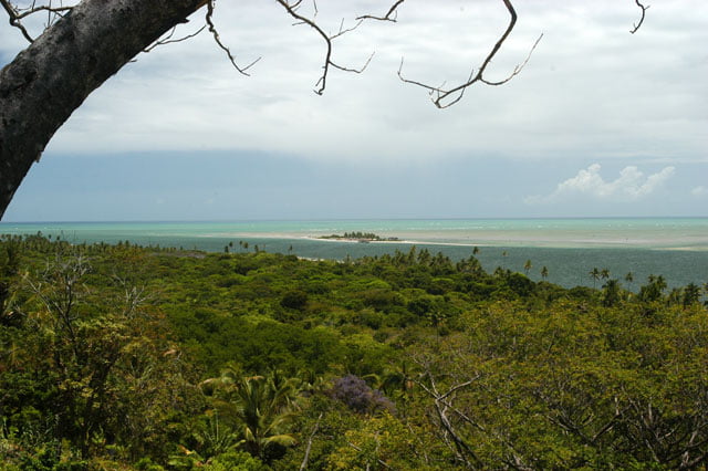
Today’s plan was to walk around and shoot Olinda. We intend to make a program devoted exclusively to Olinda, since it is one of the most beautiful cities of the Brazilian coast and it has historical buildings that make us breathless: churches, convents, colonial mansions, narrow streets, alleys, a live class of Brazil’s architecture history. Due to its importance, Olinda was recorded as historic site by UNESCO in 1982 as Humanity’s Cultural Patrimony. Additionally, since Olinda is at the top of a hill, there is a wonderful view of Recife, in the south, with the port and dozens of canals. It took us all day to work on that. It was dark when we returned to the Endless Sea anchored at Cabanga Yacht Club.
Sunday, 6 – 11 – 2005.
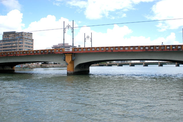
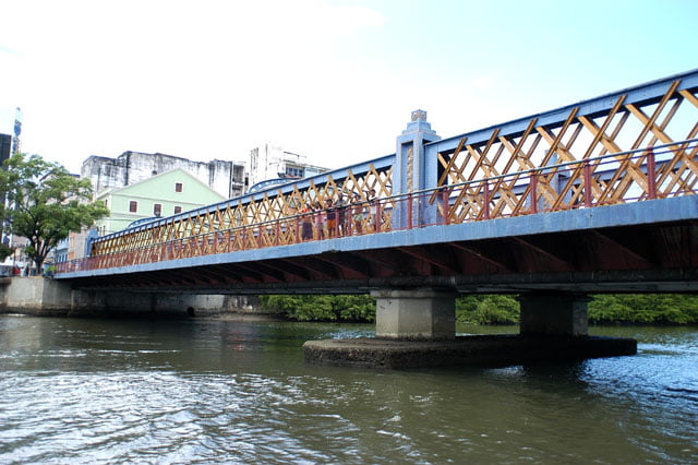
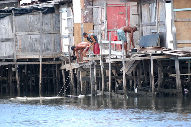
Today, we have planned to go by boat through Recife’s canals and rivers. The city was founded by the Dutch and is bellow the sea level. It was built between Capibaribe and Beberibe rivers, containing an isthmus, islands and flooded areas that were filled with earth. To show it to our TV viewers, the best thing to do is to shoot it going from the exterior to the interior, that is, from the water to the interior. Recife is one of the three metropolises of the north-east, besides Salvador and Fortaleza. It has three million and four hundred thousand inhabitants in the metropolitan area, crushed in the smallest area of a Brazilian capital. As usual, the rates of waste treatment are low, only 34% of the houses benefit from it, whereas 86% benefit from garbage collection (IBGE’s data, 2000). There is more: since it is in an estuary area, Recife was originally surrounded by mangroves that were devastated and filled with earth to build the city. Today, there are small mangrove “fringes” on a few banks, additionally some are occupied by slums with dirt, garbage, waste thrown directly into the rivers, in a degrading situation. This is another evidence of the Brazilian State failure and that of a terrible and unfair income distribution, a sad reality with which we will have to live for a long time. You don’t change a country with speeches and demagogy. The size of the State has to be diminished, “a management shock” is necessary, to make it effective. A few governors worked hard and succeeded in making their states evolve, despite everything; whereas the federal government seems to be uninterested. Today, more than 90% of the tax burden, almost 40% of the GNP are “bound expenses”. Speaking clearly, this means that after you pay public services and the social security, the government has less than 0,9% left of the total amount collected available for investments. This is very little to meet all the needs…
We spent two hours navigating either through canals, or through rivers, always with huge buildings around, and a few vestiges of the old city that resisted to time. It is a pity to see that the old city was not preserved well enough. Recife was probably wonderful in the past centuries, no wonder it is also known as the “Brazilian Venice”.
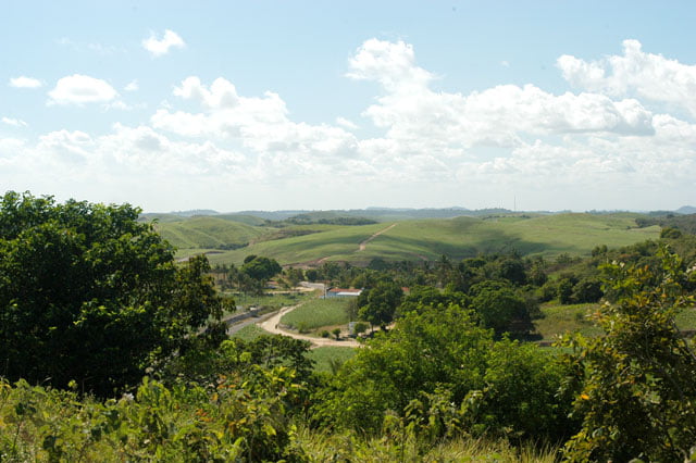
Since primordial times sugar cane has been the core of the state economy. A few historians such as Eduardo Bueno think that Pernambuco was the only successful province, especially due to the obstinacy of the first proprietor, Duarte Coelho, who as soon as he arrived he built the first sugar cane mills. The only reason why the Dutch chose Pernambuco as the main area to be possessed was the wealth resulting from the sugar production.
Since we are talking about sugar cane, let’s acknowledge that this culture was liable for the devastation of the greatest part of the Atlantic Forest in the north-east. In the beginning it was planted in Capibaribe’s valley, where there was a forest before, and today it covers completely the landscape of the south of Recife, without sparing the river banks. We could see it during our visit. There is sugar cane even on the ravines near the riverbeds; the ciliary forest was not spared. The result is pollution caused by the distillation waste and pesticides as well as the obstruction of Capibaribe, Beberibe, Jaboatão , Sirinhaém, Formoso rivers, etc. Low depth and the reefs near the coast made us leave our sailboat at the Yacht Club and go by car to the coast.
Monday, 7 – 11 – 2005.
Our destination is Itamaraca. The island is 15 miles to the north of Recife and it played an important role in the history of colonization. It was one of the first trading posts created by the Portuguese. The first one was founded by Américo Vespúcio, in Cabo Frio, in 1504. Twelve years later, in 1516, when the king decided to organize the wood trade, he sent a fleet under the command of Cristovan Jaques, “Pau Brasil’s commissioner”. He sailed to Cabo Frio to find out that it was abandoned. He decided to move it to Itamaracá near the Crown, in the Northeast, and where pau Brasil seemed to have better quality for the European dyeing. All that area had mangroves around, infested today by the crustacean culture and that’s probably where Pernambuco’s last non-industrial fishing community remains, especially in Iapissuma and Alcapuz. When we were at the Federal University we were warned by teacher Maryse Paranagua and Tarciso Quinamo, a researcher at Joaquim Nabuco Foundation, about the harmful consequences of mass tourism and that of shrimp breeding in the area.
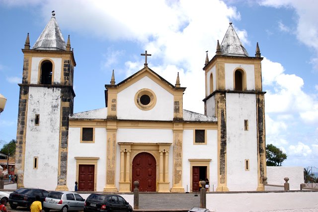
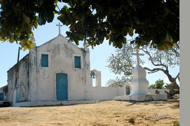
Before arriving at Itamaraca, we passed by Igarassu to shoot the oldest church still operating in Brazil. The name is Cosme and Damião and it is the result of Duarte Coelho’s efforts who before building Olinda went up with his flee Igarassu’s mouth where he founded Cosme and Damião village. Only a few years later, realizing there were strategic advantages in Olinda with a perfect view of the coast, Duarte Coelho established there his domains.
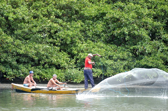
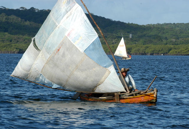
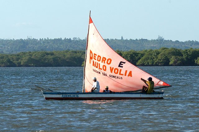
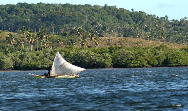
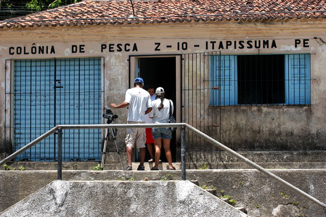
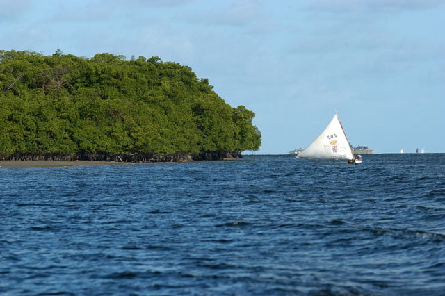
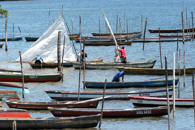
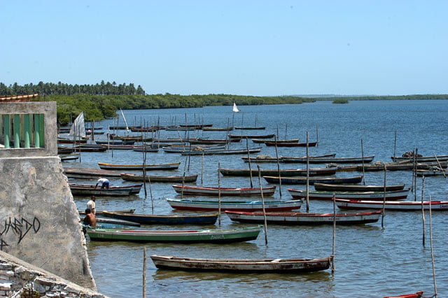
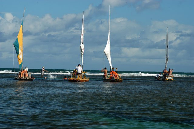
The trip by car is short. We arrived at Itapissuma in less than fifty minutes. It has approximately 20 thousand inhabitants who depend exclusively on non-industrial fishing. On Santa Cruz canal’s banks there is a small port where fishermen leave their traditional vessels. They are long and narrow canoes moved by cloth, similar to those we saw in João Pessoa. The sails are much bigger than those of Rio Grand do Norte or Ceara. It is so long that the boom sometimes exceeds the extension of the boat hulls.
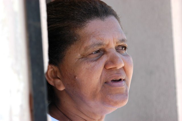
We talked to Joana Mouzinho, the president of the fishermen community. A lady full of energy and dynamic, she complained a lot about the lack of fishes and crustaceans which used to live in the mangroves and were part of the income and food for a few fishermen families. They were devastated by the crustacean culture effluents. In this district, there are breeding tanks even in the inhabitants’ courtyards, they are involved in the activity and seduced by great producers who buy their production. The other problem mentioned by Joana is building the port structure and the Santa Cruz canal dredging, a tourism project developed by the state. There have already been accidents caused by the motor boats’ propeller and fishermen. Dona Joana fears for the increasing number of boats resulting in a decreasing number of fishes. She is also against building the port structure and was able to make local inhabitants react. Their reaction made the state stop the project for the moment while a solution for the situation is found.
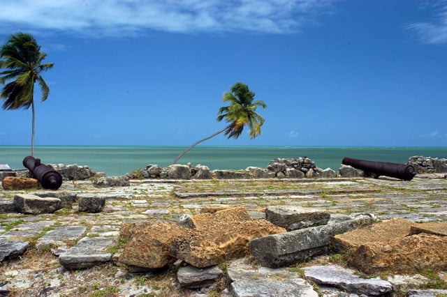
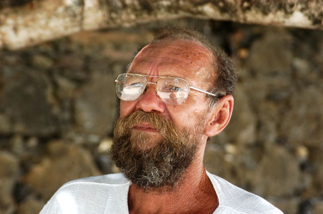
From Itapissuma, we crossed the bridge that connects the continent with the island and arrived at Itamaraca. The first things you see are huge cement walls around three prisons built on the island. Yes, there is not only one, there are three, one of which is a maximum security prison. This is an additional outcry for local inhabitants and another problem for tourism… We went straight on to the sea, on the other side, where fort Orange’s ruins are, left by the Dutch. In spite of the beauty, built on the shore at the beach, the fort is semi-abandoned. We talked to Zé Amaro, former prisoner, who is known as the fort’s guardian, because since he knew it, he has never abandoned it. When he was released he moved to the island and started to take care of it as if it were his own house. He did many things to call the authorities’ attention: he asked funds to renew it, but he only succeeded when he asked the Dutch Embassy to do something. The Embassy asked him to have a Foundation in order to receive funds. That’s what he did. And since then things have been better, the fort will not collapse, but many things must be improved do preserve the historical importance the fort has. Zé Amaro is a lovely person, very talkative, a nice person, with a long beard and strong accent. He told us things about the period during which he slept in the fort and used to eat crabs he could find in the mangrove. He is sad when he says that today there is no more life “after the crustacean culture activity started”.
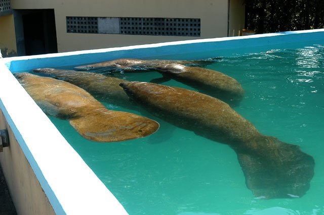
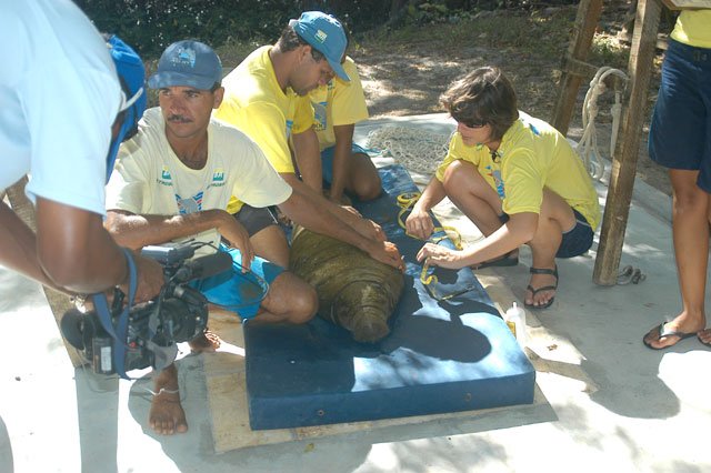
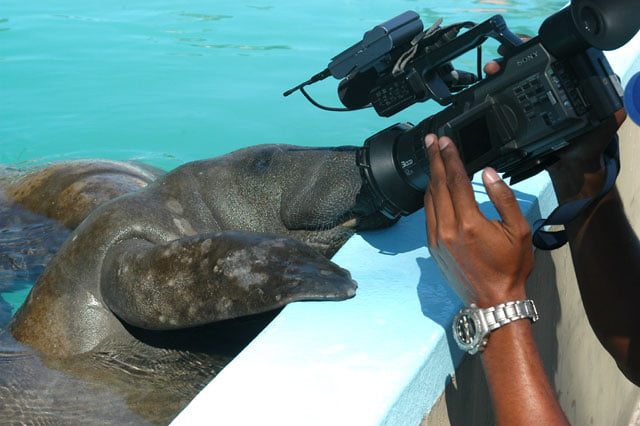
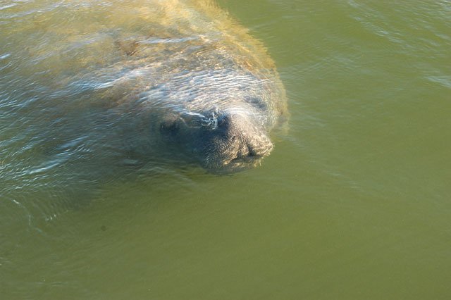
Before the end of the day, we visited Itamaraca’s Peixe-Boi Project Base. The young which entangle on the northeastern coast are brought here. We were even more surprised when we saw how the biometry process was conducted, the same peixe-boi Paulina saved when we were visiting Ceara’s coast. I wrote about this in the corresponding logbook, when we were at Aracati to see the damage caused by the greatest farm of shrimp breeding in that area and which belongs to the district’s mayor. At a certain point, we were told that a young peixe-boi had entangled at Canoa Quebrada, on the other side of Aracati. Paulina called Fortaleza’s Ibama immediately, telling them what had happened and asking them to do something about. Well, that animal was rescued and taken to Itamaraca. Here he was named B5 (baby 5), while its definite name isn’t chosen by votes. The record states clearly: rescued at Canoa Quebrada on August 29th 2005, on the same day our reporter made the phone call. Yes, your effort was not in vain. Congratulations!
Tuesday, 8 – 11 – 2005.
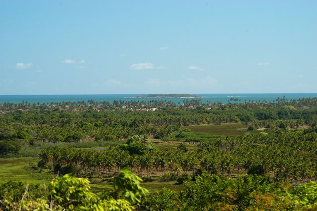
Today we are going to the south coast, to Porto de Galinhas, one of the most beautiful areas of Pernambuco’s coast d which receives the greatest amount of tourism investments. During the trip, we saw mostly sugar cane plantations on both sides of the road. The landscape is wonderful, with hills covered with sugar cane almost to the top where it is still possible to see traces of the old cover of the Atlantic Forest present all over the coast. On our way, we stopped at a few beaches to see the occupation. The first was Guaibu, one of the densest. Up to 400 or 500 meters towards the interior, there are only summer houses, one next to the other. They were built behind the first strip of coconut trees; anyway it is before the 300 meters required by CONAMA’s resolution concerning APPs (Resolution nº 303, March 20th 2002). Several times, these resolutions arrived too late since the beaches near the capitals had already been occupied. It is always the same, the state never plans anything, it is always dragged by the private initiative.
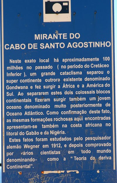
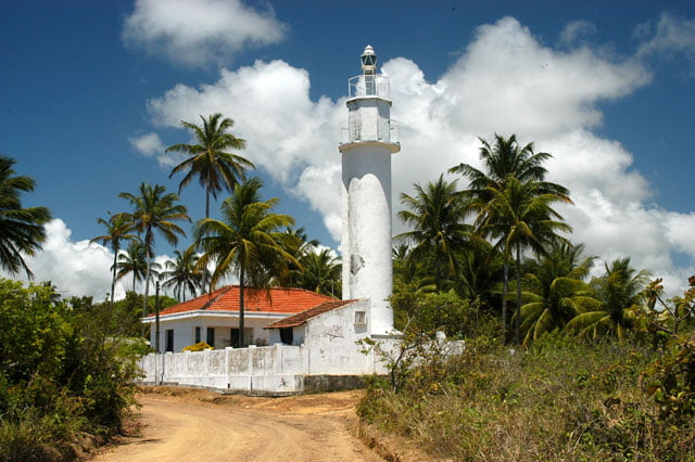
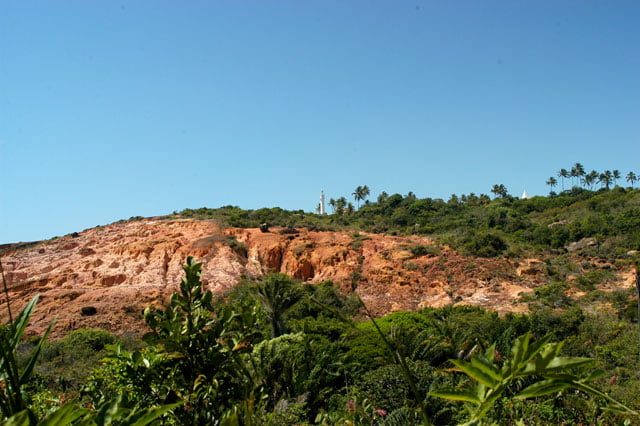
Besides Guaibu, we stopped at Corais creek and Pedra do Xaréu, both in a similar situation. Many times the bather has some difficulty to reach the beach due to the great number of houses and walls. Then we went to Farol do Cabo de Santo Agostinho (Santo Agostinho Cape’s Lighthouse), a remarkable place on the coast, well known by sailors. It is at the top of a hill from where there is a wonderful view, and the turquoise sea, typical from here, on the infinite horizon, Recife is in the north and Suape port in the south. Fortunately, from the hill where the lighthouse is, many others can be seen but without the vegetal cover and with strong signs of devastation. You just cut the forest and the rains make the rest, causing great erosion.
Deforestation in the 17th century to build a city, as it was the case of Recife, O.K. At that time the pressure to maintain and protect the environment was not very strong and there was no other way of settling in a city. But to do the same thing three centuries later is a stupidity, stubbornness, or both.
We continued on the road alongside the coast but not for too long. A little bit further, at Suape creek of quite waters, at the end of the road there is another resort, a big one with a devastating impact on the scenery: cement caissons standing out in the landscape… We have to go back to BR and go to the interior to go down towards the south.
In Pernambuco, unlike Ceara and Rio Grande do Norte, the BR is not really alongside the coast, it runs parallel with it but towards the interior. To go to the beaches you have to take detours, leave the main road and go towards cities and villages which were most of the time built on the river mouth, near the sea. Thus we continued towards Porto de Galinhas where we arrived a few minutes later.
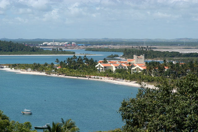
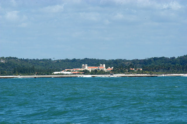
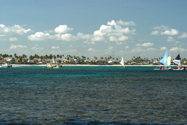
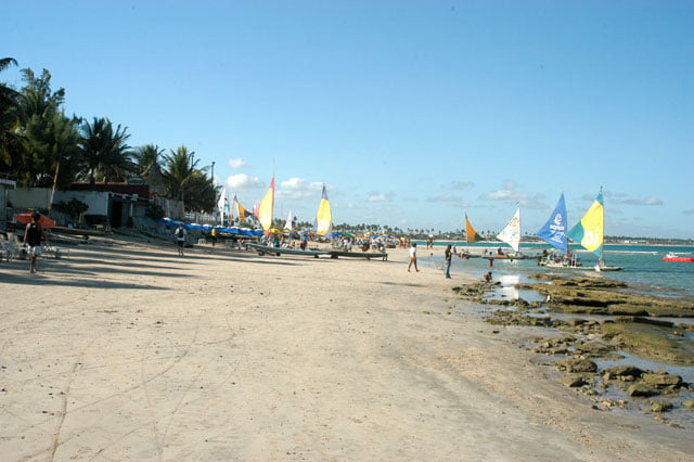
Actually, Porto Galinhas is a wonderful area. There are coconut trees all around, not very wide beaches, but quite long, always with a turquoise sea in front and swimming pools of coral reefs and waves roaring to the exterior. The beach is part of Ipojuca District which has the third greatest tax collection of the state, behind Jaboatão and Recife. Tourism was traditionally strong on the north coast, in Itamaracá, but during the last 20 years, the south has attracted significant investments. Ipojuca with 60 thousand inhabitants has seven thousand available beds today. These are domestic undertakings, followed by the Portuguese and Italians. 65% of the tourists who come here are Brazilians, most of them from São Paulo, and 35% are Europeans. The district also has laws that prohibit high buildings from being built, like in Paraiba. Here the maximum height is 14 meters which corresponds to the ground floor and three other floors above. But there isn’t any law determining a horizontal limit for occupation. The result is an increase in density.
Ipojuca’s economy is based on sugar cane; Pernambuco’s greatest ploughed fields are here, as well as on tourism that gives jobs to approximately 20% of the population’s manpower. That’s why investments are possible here. At the present moment, all the area is under work and the mayor promises a waste system serving all the houses until the end of the year. They have to work fast; there are too many people in a place with no infrastructure.
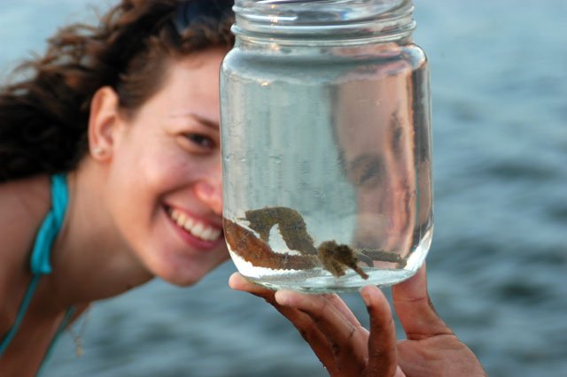
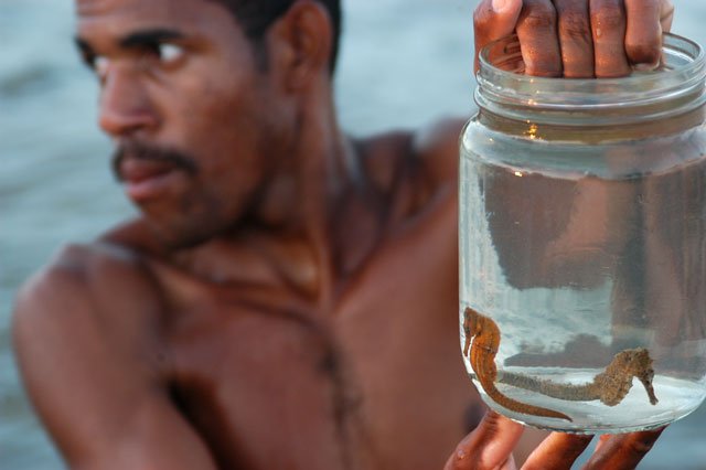
We have been to the mouth of Maracaipe, a little bit downwards, the habitat of a great colony of seahorses, these delicate fishes which live in mangrove areas.
It was late when we finished shooting, but I didn’t want to go back without going southwards, to see if real estate speculation and tourism were increasing. We decided to stay here for the night and continue tomorrow.
Wednesday, 9 – 11 – 2005.
We left early and went 60 kilometers towards the south until we arrived at Tamandare which is close to the border of Alagoas. There is a remarkable difference. The same wonderful scenery, with coconut trees everywhere, a beautiful reserve of the Atlantic Forest which is still preserved by Ibama, Saltinho Reserve, beautiful beaches, the marvelous color of the water, but tourism here is not too heavy, although the beach is quite crowded. This is amazing. Suddenly a place on the coast is fashionable and it is as if it were the only place in the world. Everybody wants to go there. Famous marks, luxury hotels, restaurants, bars, and stores of different types. And of course this attracts a lot of people, sometimes it exceeds the infrastructure capacity. Porto de Galinhas welcomes almost a hundred thousand tourists during the high season, and every year there is an increasing number and it is like Buzios, in Rio de Janeiro. It is increasing so much that it may loose the natural beauty that made it famous, it attracts a lot of people but it may loose everything. A few kilometers further, you find the same type of beach, the same marvelous scenery, but in an area that is not fashionable, consequently, less noisy, less crowded.
We returned from Tamandare and stopped at Carneiros beaches, also full of summer houses. The beach is beautiful, but it is too much occupied (see pictures) After Gameleiro, there was a beautiful bay with two resorts that were built without damaging the scenery, with one floor cottages adapted to the local architecture, one away from the other, and it is not visible from the beach (see pictures). This is good tourism: it offers jobs, warms up the economy, obeys the local infrastructure not bringing too many people, and the most important thing: there is no on the environment! We have this nice example on the south coast, and I hope it proliferates at the other 5 or 6 unoccupied beaches.
Our next stop was Sirinhaem River’s bar, probably the most spared in the area. The same beauty, but almost no tourists or summer houses. Local inhabitants live from non-industrial fishing.
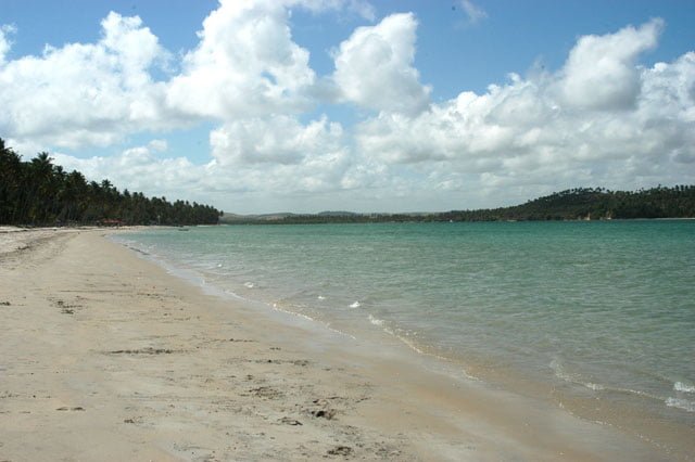
Thus we ended our visit, having covered all Pernambuco’s coast, except São José da Coroa Grande, at Alagoas’ border, which we intend to visit during our next trip. I was not happy with what I saw. The occupation of Pernambuco’s south coast, in spite of the tourism boom, it is not as harmful as it is in Ceara and Rio Grande do Norte. Neither it is an example of well planned occupation, except a few special cases. Buildings are less aggressive and the areas occupied by shrimp farms are smaller. As far as the scenery is concerned, the type of sea and coast, it couldn’t be more spectacular.
Thursday, 10 – 11 – 2005.
We spent the day making researches at Joaquim Nabuco Foundation. We will be in Alagoas soon, the São Francisco River’s land, this is an issue that is being discussed everywhere in Brazil. We talked to researcher João Suassuna who has been studying issues involving the river for ten years.
He is against the project. He thinks it is absurd an investment of 4.5 billion reais by the federal government in a work that will not bring the expected results.
Suassuna shows interesting data. According to him, there is a lot of water in the Northeast, but there isn’t any plan to make a better use of it. The area has 70 thousand reservoirs which store 37 billion liters of water. And he adds: “It is the world’s greatest potential of water in semiarid.
The drought problem faced by the poor in the Northeast, the water trucks used by demagogues to win people’s votes, this situation is due to lack of political will. And he warns: once the transposition is over, the trucks will be used again.”
João Suassuna explained to us that the São Francisco River is very poor in hydric resources. Its outflow capacity is 2.800 cubic meters per second for 640 thousand square kilometers of basins, whereas Tocantin’s outflow, which is as big as São Francisco, is 11 thousand cubic meters per second. Suassuna said: “60% of the river flows in the semiarid where there is significant evaporation and part of the affluents are temporary rivers.” According to him, the São Francisco River doesn’t have water to supply the concessions that have already been given.
He also said that last year in August, SBPC’s annual meeting (Brazilian Society for the Progress of Science) gathered the greatest experts on this issue and decided not to carry out the project.
The government intends to build 700 kilometers of canals (25 meters wide and 5 meters deep), to make São Francisco’s waters flow to dams and reservoirs, surmounting heights of 500 meters, helped by pumps, crossing an area where there is evaporation, with a lot of sun and strong winds. It is the greatest infrastructure work since Itaipu (the hydro-electric power station) was built in the 80’s.
According to Suassuna, Embrapa has better projects to make a better use of stored water in the Northeast, but “they are forgotten in drawers” and most of the transposed water will evaporate in its course. Additionally, there are crystalline rocks on the soil of the canals, thus dynamite will be necessary to build them, therefore, cost will be high and the environmental impact will be significant.
João Suassuna says that 95% of the power supply in the Northeast comes from the São Francisco River, “CHESF explored all the potential of the river”, but the region grows at greater levels. In 2003, the growth was 4,5 of the GNP. In 2004, there was vegetative growth. But in 2005, an increase of approximately 3,5 of the GNP is expected…” Since the demand for power is normally 2,5% above the GNP, a new rationing period is expected, otherwise…”where is the supply of the Northeast coming from?”
He concludes saying that the country should extend its power resources, based especially on hydrology. “Any disorder in the rain regime, which is occurring now in the Amazon and the result is chaotic. The Northeast could contribute more with aeolian or solar energy, but the government has apparently chosen the worst option: thermoelectric power stations, the most expensive source, extremely pollutant in whose waste several cancerous substances are found.”
Suassuna talked with us for a long while and was inflexible in regards the huge project the government, without enough credibility, intends to carry out during an election year.
In spite of these arguments and many others such as those mentioned by a famous hydrologist, João Abner, from a receptor state, Rio Grande do Norte, or those described by geographer Azis Ab’Saber, the government insists on going on. The National Integration Department headed by Ciro Gomes, boasts about it saying that “it is a self-sustainable work that will be ready in 2007 and will abolish the drought industry.
Place your bets, gentlemen, there are no limits.
Anyway, you should know that the World Bank has doubts about the project’s economic viability and it will not support the transposition.
P.S.: Since it is a complex issue, it is impossible to summarize it in a simple report. That’s why we included in the “suggested links” section of our site one link with lots of studies and articles on this subject, according to Suassuna’s suggestion. If you want more information, try it.
Friday, 11 – 11 – 2005.
Paulina left in the early morning. She is taking two tapes with her to São Paulo and will start editing the programs. Cardozo and I were supposed to find some electric items that are necessary for the sailboat maintenance, and then go to Porto Galinhas today, in order to rest before sailing to Maceio. However, it was extremely difficult to find the right stores. We went to several places and faced heavy traffic, which ordinarily occurs in Recife, and we spent all day on that.
We noticed that the city is not as well treated as the other capitals we have visited. All of them have lots of problems, but usually they are cleaner and better signalized.
Saturday, 12 – 11 – 2005.
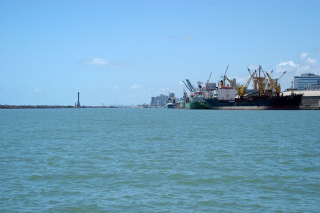
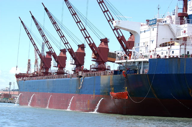
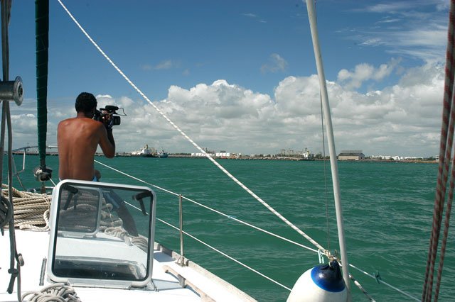
In the early morning, with the Endless Sea fuelled, the hull clean and good weather with east wind between 13 and 15 knots, we left Cabanga Yacht Club, where we had been well received, for Porto de Galinhas. On our way, we will shoot Suape’s port and refinery, the great villain of the biggest environmental damage on Pernambuco’s coast.
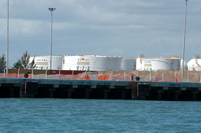
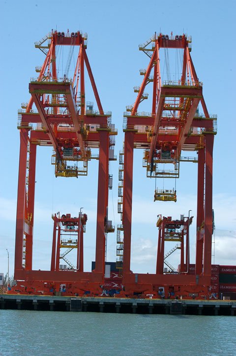
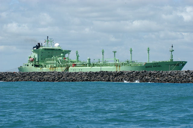
Suape offers an important geographic advantage: it is five days and a half away from the American east coast and from Rotterdam, in Holland. It is only 40 kilometers away from Recife. It will be one of Brazil’s most modern ports. These were some of the aspects examined by Petrobras when the place that will also shelter Abreu and Lima refinery was chosen, a project of 2,5 billion dollars, it is a partnership with Venezuela’s state company PDVSA. In 2010, 2011, it will be operating, producing gas, diesel and naphtha, a by-product that is often used by petrochemical companies. This attracts more companies such as the Italian Mossi & Gisholfi which will manufacture plastic resin and polyester. There are also manufacturers of purified terephthalic acid (PTA) as well as a paraxylene (PX) manufacturer. But there is more: Camargo Correia intends to build in the same place the greatest shipyard of the Southern Hemisphere, specialized in vessels and off-shore oil platforms. All this brought a lot of investments, environment devastation, jobs, and it will turn Suape into an industrial park and the big Brazilian port of containers’ distribution; one million containers per year, according to expectations.
There is also an old project abandoned in the 90’s, building the Transnordestina railway. It is controlled by the CSN group and it depends on the federal government’s support which will finance 90% of the total amount, more than 5,5 billion reais. Recife’s bathers will have to pay for it as well as the local environment, it’s inevitable…
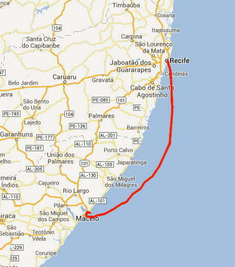
Recife is 300 miles away from Porto de Galinhas and Maceio is 85 miles away from it. We arrived at the first stop at about 11 a.m. The beach was crowded, from the sea you can only see the roof of the houses, some higher buildings and hundreds of beach stands.
I dove and checked if the Endless Sea’s hull was clean and if the chicken foot ( a piece that holds the axle) was well fixed. When we were in Amapa and grounded in Calcoene’s river we noticed this piece was loose. The accident made us see the piece, if we hadn’t seen it, we would have had serious problems during our trip to Macapa. I’ve been checking it since then. Fortunately, it was all right.
Great. Free time for a barbecue on board, then a good nap rocked by the swinging of the waves. At midnight, we left for Maceio.
Sunday, 13 – 11 – 2005.
I woke up at 4 a.m. when Alonso started the sailboat motor…
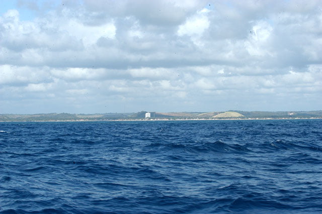
It was excellent and I will tell you why: since I left at daybreak, I could see the shore, we had sailed just 5 miles. When you are at the beach, it is difficult to have an exact idea of the room occupied by a building or any sort of interference. This is so because the observer has the same perspective. It is impossible to know exactly the proportion the new building will have, or which part of the original scenery it will “steal” because you don’t see the whole thing.
But when you see the shore, all the elements are available: the beach in the middle, the surroundings on both sides, behind, and the sea in front of it. Now you have the perspective. Then an observer can realize how much room was occupied and what kind of interference it caused. Pay attention and see what you will look at, after a general view of the scenery (test it with the pictures of this trip). See if you have looked at the natural scenery, at the erosion at the top of the hill, at the telephone antenna, or any thing made by men. Try again. If your eyes were “hypnotized” by the natural beauty, then you will know that the occupation is “self-sustainable”, that is, there is a low impact, and you don’t even notice it. Usually, the beach is as beautiful as it was originally, and the maritime life chain won’t be much affected, although there is some economic option there. But when your eyes are caught by the human interference and that disturbs the harmony of the scenery, and then it is unsustainable. To begin with, the undertaking doesn’t even preserve the natural beauty because it grabbed your attention. It pollutes visually and environmentally speaking. It changes a millenary landscape. It makes an extremely fragile ecosystem defenseless, since 90% of the whole maritime chain starts at the shore. If that’s the situation, then it is a harmful occupation. At least, these are the criteria I take into account when I give an adjective to this or that part of the coast. And sailing in these waters, near the shore, I realize that the occupation caused a harmful impact on the scenery most of the time. When we talk about cities such as Recife, Fortaleza or Natal, or undertakings as big as Suape and Pecem’s ports, it’s inevitable. But when at non-urban beaches, devoted to tourism, summer activities or extraction, we have to fight for an occupation which preserves the natural scenery, haven’t we? It is perfectly possible to occupy without any damage. All you need is good sense, sense of proportion and some information. As regards the exuberance of nature and the original landscape, all Pernambuco’s beaches were damaged. The only question is if the infrastructure that is unavailable will be available before a new growth boost, or after. If it is after, as it has been the rule, I can assure you that there will be a serious impact on biodiversity, even if it doesn’t look so.
The only exceptions are the last five or six beaches at the south end of the state which are below Tamadare’s Bay, Varzea do Una , São José da Coroa Grande, near Alagoa’s border.
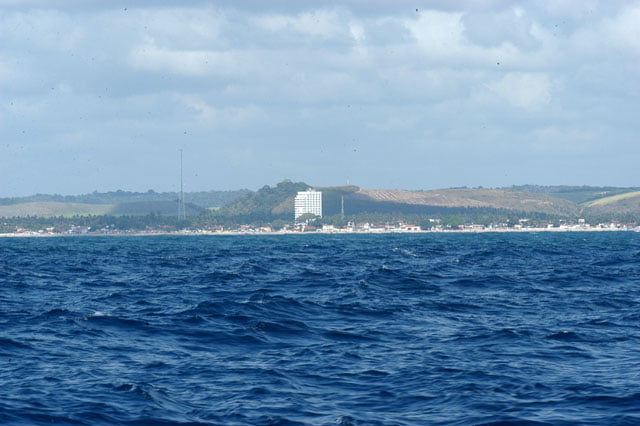
By the way, it is good to know which remarkable point is the border between the two states for those who come from the sea. I was enjoying the breeze, the comfort and the all-embracing view from the cockpit, when Alonso called my attention saying: “João, can you see that white spot on the prow, at two p.m.? “Two p.m. is the clue for the angle formed between the sailboat prow and the point you want to show on the right, as if there were a clock indicator pointing at two p.m.
I looked at it and I saw. A big concrete wall, too high for a non-urban area.
What is that, I thought, such a big thing, horrendous and aggressive, visible miles away?
I checked with binoculars: a huge building, a horrendous caisson. Grey and lonely, high and wide, devastating the scenery that took thousands of years to be formed. It is, above all, unnecessary since it is not in a big city where normally there isn’t enough room and in the middle of a small coastal village where such pressure is absent; Why? But there is an intruder, occupying the landscape as a sovereign, an incontestable witness of the prowess of an incautious person. Additionally, it is a permanent trophy of bad taste and esthetical deformation of the maritime environment (see on the site the last picture of this stage).
Why should the scenery be preserved? Because it is rare, unique, usually with subtle charming shapes in a range of colors and harmony. It is beautiful and fascinates the eyes. And from the complex system of relationships and connections emanates life. Occupying the coast badly means to contribute to turn the sea into an inanimate desert. And we are responsible for that, for the simple reason that Brazil’s coastal zone is one of the biggest a country can have, with approximately eight thousand kilometers. And who shall be blamed for this bad occupation but ourselves?
If you think it is just the opinion of a poor journalist, be on your guard. Take note and spread what comes next: “The Coastal Zone is a national patrimony. The utilization must be conducted in a sustainable way”. Paragraph 4, article 225. Brazil’s Federal Constitution.
See you in Alagoas.